1.820.3345.33 [email protected]

Login

Sign Up

After creating an account, you'll be able to track your payment status, track the confirmation and you can also rate the tour after you finished the tour.
Username*
Password*
Confirm Password*
First Name*
Last Name*
Birth Date*
Email*
Phone*
Country*
* Creating an account means you're okay with our Terms of Service and Privacy Statement.
Please agree to all the terms and conditions before proceeding to the next step

Already a member?

Login

Login

Sign Up

After creating an account, you'll be able to track your payment status, track the confirmation and you can also rate the tour after you finished the tour.
Username*
Password*
Confirm Password*
First Name*
Last Name*
Birth Date*
Email*
Phone*
Country*
* Creating an account means you're okay with our Terms of Service and Privacy Statement.
Please agree to all the terms and conditions before proceeding to the next step

Already a member?

Login

Manaslu Circuit Trek – 16 Days

0
Price
From$3,400$2,400
Price
From$3,400$2,400
* Please select all required fields to proceed to the next step.

Proceed Booking

Save To Wish List

Adding item to wishlist requires an account

1590
Trip Details
  • Activity and AttractionsManaslu Circuit Trek
  • AccommodationHotel, Lodge, or Tea House during the trek: Teahouse or Guest House
  • RegionManaslu Region
  • Distance177km/109.9Miles
  • Start / End pointKathmandu to Kathmandu
  • Duration16 Days to Explore the Manaslu Circuit Trek
  • Max. Altitude5,160 m at Larkya La Pass 5,106 m (16,751 ft) | 5,215.00 m
  • Meals IncludedAll Meals (Breakfast, Lunch & Dinner) during the trek
  • Group size2-30
  • Best SeasonMarch, April, May, September, October, and November. March-May and September-December. March-June and September-November. Autumn (September to November) and Spring (mid-March to mid-May).
  • Trip CodeAGEH0015
  • Activity Per DayApproximately 4-6 hrs walking
  • TransportationPublic Transportation from Kathmandu to Sotikhola via Arughat, & Dharapani to Kathmandu via Besisahar
  • GradeChallenging
  • DestinationNepal

Manaslu Trek Overview

The mesmerizing Manaslu Trek takes you along a relatively off-the-beaten path, leading to beautiful landscapes, fierce white-water rivers, and dense forests, all culminating at Manaslu Mountain (8,163 m / 26,781 ft), the eighth-highest peak in the world. The 16-day Manaslu Circuit Trek is one of the most famous treks in the Himalayas, renowned for its less-crowded trekking route and off-the-beaten-trail experience. The trek offers a unique adventure, abundant flora and fauna, a fascinating cultural heritage, and breathtaking mountain panoramas. Manaslu Trek is often considered a hidden gem in the crown of Himalayan trekking.

Manaslu Circuit Trek in Nepal is a privilege that only a select few travelers experience each year. The trek in this region opened in 1992. Since it traverses a restricted area in Nepal, special permits are required to enter. In addition to the high cost of permits, other regulations such as trekking with a registered Nepali trekking company and the requirement for a minimum of two trekkers per group (excluding the guide and porter) help limit the number of tourists in the area.

The Manaslu Circuit Short Trek, offered by Trekking Planner Nepal in 2024 and 2025, promises an enjoyable and exciting adventure. You’ll be accompanied by expert guides and field staff, as well as cheerful porters to carry your heavier luggage. Your needs will be well taken care of from arrival to departure in amazing Nepal, a country rich in Himalayan wonders and colorful cultures.

Manaslu Region and History

The Manaslu Circuit Trek takes you through the restricted and scenic regions of North Mid-West Nepal, in the Mansiri Himalaya range. It was opened to outside visitors in 1991, and a special permit is required to enter the high Manaslu valley. The trek starts in the Gorkha district, with some parts after the Larke-La Pass falling within the Manang region.

Mt. Manaslu, standing at 8,163 m (26,781 ft), is the world’s eighth-highest peak. First summited by a Japanese expedition on May 9, 1956, it has since been climbed by various national expeditions each year.

The name “Manaslu” comes from the ancient Sanskrit word “Manas,” which means “mind” or “soul” of a god, or holy spirit. Similar to Lake Manasarovar near Tibet’s holy Mt. Kailash, the locals refer to the mountain as “Quoting,” which translates to “heavenly mountain” or “abode.”

Upper Manaslu was also an important part of the Old Trans-Himalayan Salt Trade and Caravan Route, connecting Nepal to Tibet. Bartering and trade of goods still occur in smaller quantities today. Dharmasala, or Larke Phedi (bottom), used to be a bustling marketplace known as Larke Bazaar, where villagers from Gorkha, Manang, and even Tibet exchanged goods such as grains and wool.

Trekking Experience

Today, there are a few lodges for trekkers to stay overnight before crossing the high Larke-La Pass to reach the Manang area. Trekking Planner Nepal’s Manaslu Circuit Trek will take you through all the scenic and culturally rich villages, ensuring that you have ample time for acclimatization before heading toward the Larke-La Pass. On this trek, you’ll immerse yourself in the local culture, which is deeply intertwined with Buddhism.

The highest point on the trek is the Larke-La Pass, at 5,106 m (16,752 ft). Our experienced guides and staff will ensure that each trekker is in good health before crossing the pass. We regularly check on our clients’ conditions during the trek, providing excellent services and care throughout the journey, making every trip a success.

Manaslu Circuit Trek is an ideal option for those seeking an off-the-beaten-path trekking experience. Located in the western part of Nepal, bordering Tibet, the trek offers glorious views of Mt. Manaslu (8,163 m), the eighth-highest mountain in the world. Opened for trekking in 1992, this region remains less frequented, offering a pristine and untouched environment. Even during the peak season, you’ll find only a few trekking groups, preserving the natural beauty and cultural heritage of the area.

Natural and Cultural Highlights

Along the trail, you’ll be treated to stunning views of snow-capped peaks, shimmering glacial lakes, and diverse flora and fauna. The Manaslu region is home to a unique blend of Tibetan-Nepali culture. The Tamang and Sherpa people who reside here provide an opportunity to experience a way of life that is markedly different from the rest of the world. As you pass through small villages, you’ll glimpse the daily lives of these people, and immerse yourself in a truly unique culture.

After a few days of trekking from Sotikhola, the trail divides. The left trail follows the Budi Gandaki River on the regular circuit, while the right trail leads to the Tsum Valley, known for its distinct Tibetan culture.

Conclusion

The Manaslu Circuit Trek is undoubtedly one of the finest treks in Nepal. However, due to its location in a restricted area, special permits are required. Along the way, you’ll be treated to spectacular views of Himalayan giants such as Mt. Manaslu (8,163 m), Himlung (7,126 m), Cheo Himal (6,820 m), Annapurna II (7,937 m), Chuli (5,895 m), and Larke Peak (6,476 m). The region also boasts rich biodiversity, including 19 types of forests, mostly Himalayan blue pine and rhododendron, and 110 species of birds, including the Himalayan Griffon, Golden Eagle, Crimson Horned Pheasant, and Tibetan Snow Cock.

Manaslu Circuit Trek offers an unforgettable experience for trekkers seeking adventure, natural beauty, and cultural immersion.

Highlights of the Manaslu Circuit Trek 

  • Scenic drive from Kathmandu to Soti Khola
  • Views of the world’s highest peaks, including Manaslu Mountain (8,163 m), Lamjung Himal, Mt. Annapurna II, and more
  • Trek along the Budhi Gandaki River gorge
  • The highest point on the trek: Larkya La Pass (5,106 m / 16,751 ft)
  • Rich biodiversity and stunning natural scenery
  • Captivating flora and fauna
  • Insight into Hindu and Buddhist cultures
  • Possibility of spotting endangered wild species, such as the snow leopard
  • Adventurous off-the-beaten-path trekking route
  • Less crowded, offering ample time to enjoy tranquility
  • Trek through remote villages and dense forests
  • Experience ancient Tibetan Buddhist culture and enjoy the warm hospitality of locals
  • Visit old monasteries and stupas along the way
  • Cross the challenging Larkya La Pass
  • Witness astonishing landscapes and excellent morning views

Additional Highlights

  • Adventure through the high scenic Manaslu Valley and cross the towering Larkya La Pass
  • Explore the restricted region of the Mid-West Himalayas and its impressive villages
  • Traverse from the remote Gorkha District and Manaslu Valley to the Manang area
  • Trek from warm lowlands with paddy fields to cooler hills, and finally to the arctic zone of ice and glaciers
  • Follow the ancient Trans-Himalaya Salt Trade Route between Nepal and Tibet

Final Highlights

  • Off-the-beaten-path trekking experience
  • Breathtaking scenery throughout the trek
  • Experience the vibrant blend of Tibetan-Nepali culture and tradition
  • Stunning views of snow-capped mountains, shimmering glacial lakes, and diverse flora and fauna
  • Magnificent views of Himalayan giants including Mt. Manaslu, Himlung, Cheo Himal, Annapurna II, Mt. Chuli, and Larke Peak
Short Itinerary:

Day 1:
Drive from Kathmandu via Arughat to Soti Khola (730 m)
Maximum Altitude: (1400m/4593ft)
Trekking duration:
8 hours

Day 2:
Trek from Soti Khola to Machha Khola (890 m)
Maximum Altitude: (1400m/4593ft)
Trekking duration: 7 hours

Day 3:
Trek from Machha Khola to Doban (1,070 m)
Maximum Altitude: (900m/2953ft)
Trekking duration: 5 hours

Day 4:
Trek from Doban to Philim (1,570 m)
Maximum Altitude: (1340m/4396ft)
Trekking Duration:  4 to 5 hours

Day 5:
Trek from Philim to Deng (1,860 m)
Maximum Altitude: (1865m/6102ft)
Trekking Duration: 6 to 7 hours

DAY 6:
Trek from Deng to Ghap (2,250 m)
Maximum Altitude: (2397m/7864ft)
Trekking Duration: 7 to 8 hours

DAY 7:
Trek from Ghap to Namrung (2,660 m)
Maximum Altitude: (3180m/10433ft)
Trekking Duration: 5 to 6 hours

DAY 8:
Trek from Namrung to Lho (3,180 m)
Maximum Altitude: (3520m/11549ft)
Trekking Duration: 5 to 6 hours

DAY 9:
Trek from Lho to Samagaun (3,530 m)
Maximum Altitude: (3520m/11549ft)
Trekking Duration: 5 hours

DAY 10:
Rest Day in Samagaun
Maximum Altitude: (3875m/12713ft)
Trekking Duration: 5 to 6 hours

DAY 11:
Trek from Samagaun to Samdo (3,875 m)
Maximum Altitude: (4998m/16397ft)
Trekking Duration: 4 hours

DAY 12:
Trek from Samdo to Dharamsala (4,480 m)
Maximum Altitude: (4460m/14633ft)
Trekking Duration: 4 to 5 hours

DAY 13:
Trek from Dharamsala to Bhimtang (3,720 m) by crossing Larkya la Pass (5,160 m)
Maximum Altitude: (5160m/16925ft)
Trekking Duration: 8 to 9 hours

DAY 14:
Trek from Bhimtang to Gho (2,550 m)
Maximum Altitude: (1930m/6440ft)
Trekking Duration: 6 to 7 hours

DAY 15:
Trek from Gho (2,550 m) to Dharapani (1,910 m)
Maximum Altitude: (1400m/4593ft)
Trekking Duration: 7 to 8 hours 

DAY 16:
From Dharapani to Besisahar (760 m)
Trekking Duration: 12 hours 

Price includes and excludes
Includes
  • Transportation from Kathmandu to Arughat and Soti Khola (trek starting point), and from Dharapani (trek ending point) back to Kathmandu by public bus. All standard full-board meals (16 lunches, 15 dinners, and 16 breakfasts) provided during the trek.
  • Airport transfer upon arrival and departure. All airport pickups and drops will be by private vehicle.
  • Three meals a day (breakfast, lunch, and dinner), along with tea or coffee during the trek.
  • Snacks (cookies) and seasonal fresh fruits every day
  • Wages for guides and porters, including their meals, insurance, lodging, transportation, and equipment costs. Professional, English-speaking, and first-aid trained local trekking guide. One porter provided for every two trekkers. (No porter for solo trekkers.)
  • All government, local taxes, and official expenses. Official expenses, including all local and government taxes, and VAT. All applicable government and local taxes as per the itinerary. All government and local taxes
  • Welcome and farewell dinners in Kathmandu at an authentic restaurant end of the trek.
Excludes
  • International flight airfare tickets and Nepal entry visa are included. No departure tax is required for international flights from Kathmandu.
  • Personal expenses include items such as snacks, alcoholic and non-alcoholic beverages (including bottled water, tea, coffee, and cold drinks), Wi-Fi, hot showers, battery recharges, phone calls, laundry, bar bills, extra porters, and any additional charges for baggage or services.
  • Personal expenses also cover costs for personal travel and health insurance, as well as insurance for helicopter evacuation.
  • participants are required to bring their own personal trekking gear.
  • Tips for the trekking crew, including guides, porters, and drivers, are appreciated.
  • Diner and lunch in Kathmandu.
Itinerary

Day 01: Drive from Kathmandu via Arughat to Soti Khola (730m / 2896ft)

The trek begins with a drive from Kathmandu along the Prithvi Highway, following the Trishuli River. The views along the road are unparalleled – traditional villages, terraced fields, white-water rivers, lush forests, and towering mountains, including Annapurna, Manaslu, Langtang, and Ganesh Himal. We will continue our bus ride until we reach Soti Khola, the gateway to the Manaslu trek. Our first night on the trek will be spent at Soti Khola.

Upon arrival in Kathmandu, our Trekking Planner guide and staff will greet you with a warm traditional welcome at the airport, according to your flight’s landing time. You will have no trouble reaching the hotel and checking in. Before leaving you, our team will provide a brief overview of the trek, collect your passports and photos for the necessary permits, and answer any questions you may have.

After checking in and freshening up from your flight, take some time to explore the bustling streets of Thamel.

The next day, you’ll meet the rest of the group in the hotel lobby for a briefing about the Manaslu Circuit trek. This session will cover important information on the trek’s do’s and don’ts, local culture, and other vital details to ensure you have an enjoyable and memorable holiday in Nepal.

In the evening, we will enjoy a group dinner at an authentic Nepali restaurant, where you can savor traditional local cuisine and enjoy a folk cultural performance.


Trek Distance: 160km / 99.4miles
Highest Altitude: (1,350m/4,430ft)/(1400m/4593ft)
Trek Duration: 7 to 8 hours

Day 02: Trek from Soti Khola (730m / 2896ft) to Machha Khola (890m / 2,965ft)

This will be the first day on the trail. We wake up at Soti Khola, prepare for a long day of trekking, and head towards Maccha Khola. The path is breathtaking, with waterfalls along the way. The trail involves sharp ascents and descents, so be cautious. We will pass through Sal forests, walk beside towering cliffs, and occasionally encounter mules along the path. Our journey will take us through Khursani village, the Lububesi Gurung settlement, and finally reach Machha Khola.

On this day, we will also arrange the special and restricted permits required for the Manaslu Circuit trek.

Optional Tour: You can take a historical tour of Kathmandu, guided by one of our professional tour guides. During this tour, you’ll visit three important temples: Pashupatinath Temple, Swayambhunath Stupa, and Boudhanath Stupa. You’ll learn about Nepali history, culture, art, and architecture.

Later in the day, we will hold a small briefing session about the trek, where you’ll meet your trek guide and make final preparations for the journey. We’ll do a final check of your packing and ensure everything is in order.

Kathmandu Sightseeing Tour: Enjoy a day exploring the best of Kathmandu’s cultural heritage sites and World Heritage Sites, with time for trek preparation. The tour will include:

  • Kathmandu Durbar Square
  • Swayambhunath Monkey Temple
  • Boudhanath Buddhist Stupa
  • Pashupatinath Hindu Temple

Kathmandu Durbar Square is famous for its handicraft shops and narrow cobbled alleys leading from ancient palaces to stunning temples. Swayambhunath, located atop a hill, offers panoramic views of the entire Kathmandu Valley and is home to hundreds of monkeys that reside in the surrounding forest. Boudhanath is said to be the tomb of a legendary sage who achieved enlightenment. Pashupatinath is a sacred burial site for Hindus, with many devotees and Gurus residing here. If you wish, you can even ask one of these holy men for a photo with you!


Trek Distance: 9.7km / 6miles
Highest Altitude: (890m/2,965ft)/(1400m/4593ft)
Trek Duration: 6 to 7 hours

Day 03: Trek from Machha Khola (890m / 2,965ft) to Doban (1,070m / 3510ft)

We haven’t gained much altitude yet, as you can tell from the sub-tropical vegetation surrounding the trek. However, be prepared for some ups and downs along the way. You will cross two major rivers: Tharo Khola and Machha Khola. After crossing Machha Khola on a suspension bridge, we will enter Tatopani, but continue along the path through forests, eventually reaching Doban. “Doban” means the confluence of two rivers in Nepal, and true to its name, Doban is located at the junction of the Shari Khola and Sarpu Khola rivers.

The day begins early with a hearty breakfast in Kathmandu before we drive to Machha Khola. The drive is long, so prepare yourself to enjoy the scenic countryside views, though be aware that the road can be bumpy at times.

This marks the start of an early morning, long, and interesting overland journey to Nepal’s Mid-West, offering a chance to observe the traditional farming life of rural Nepal.

The drive follows the main highway, passing through villages and towns, until we reach the district of Gorkha and the Arughat farm town. From there, we will transfer to a local vehicle suitable for the rough dirt roads and continue to Soti Khola for an overnight stop. Soti Khola is a moderately-sized farming village situated near the banks of the Buri-Gandaki River.


Trek Distance: 9.5km / 5.9miles
Highest Altitude: (900m/2953ft)/(1,070m / 3510ft)
Trek Duration: 7 to 8 hours

Day 04: Trek from Doban (1,070m / 3510ft) to Philim (1,570m / 5,150ft)

After breakfast in Doban, we continue our journey toward Philim, reaching it by the end of the day. The trek begins with a sharp climb to Louri and continues until Thado Bharyang, located just below Jagat. We then cross a river to reach Jagat, a Tibetan-style settlement, and cross another river to arrive in Philim, a Gurung village.

From Machha Khola, we cross a river and ascend to Khorla Besi. Gradually, the trail leads us through a beautiful gorge, passing lovely waterfalls and occasional landslides. We will then reach Tatopani village, famous for its natural hot springs. Afterward, we cross the Budhi Gandaki River on a thrilling suspension bridge. Continuing past Doban, we cross another suspension bridge over the Yaru Khola and ascend to Thado Bharyang. From here, the route will take us to Jagat.

In the morning, from Machha Khola (Fish Stream), we walk to the Khola Besi village and then to Tatopani, where we can enjoy a refreshing break at the natural hot springs, time permitting. The trail continues as the valley meanders into a narrow gorge, and we cross a suspension bridge before entering a small forest on our way to Doban, a small settlement located on a high shelf overlooking the Buri-Gandaki River.

The walk proceeds by crossing another bridge and climbing to a high ridge before descending into the valley at Yara Khola (Stream). After another hour of walking, we reach Jagat.

Jagat is an interesting hill farming village, inhabited by various hill tribes including Magar, Gurung, Chettris, Brahmins, as well as Manaslu Bhotia (Tibetan-looking tribes) and some Newar people who run most of the lodges and shops.


Trek Distance: 13km / 8miles
Highest Altitude: (1,570m / 5,150ft)/(1340m/4396ft)
Trek Duration: 5 to 6 hours

Day 05: Trek from Philim (1,570m / 5,150ft) to Deng (1,860m / 6,102ft)

We continue our trek northwards through terraced millet fields, eventually reaching Ekle Bhatti. The path becomes steeper as we pass through sharp gorges and cross the Budhi Gandaki River. We continue along the riverbanks and then pass through bamboo forests, leading to the Deng Khola river. After crossing this river, we reach Deng, our destination for the day. The trail steeply ascends over a rocky ridge to Salleri, after which we descend to Sirdibas and continue trekking toward Ghatta Khola. We then cross a long suspension bridge to reach Philim. From here, we walk north across millet fields to Ekle Bhatti. Trekking through grasslands, we cross the Budhi Gandaki River again and follow the riverbank. The trail gradually opens up, and we pass more bamboo forests before reaching Deng Khola. Finally, we cross the Deng Khola to reach Deng village.

Leaving Jagat, the trail heads toward scattered farm villages, climbing through terraces of golden wheat and barley fields, eventually reaching Philim village.

In the morning, the trail ascends to a rocky ridge top covered with bamboo groves, and then reaches the small settlement of Ekle Bhatti. After a short rest, we continue higher, with the path diverting to the northwest toward Dyang, a small village with a strong Buddhist culture, where we will end the day’s walk.


Trek Distance: 11km / 6.8miles
Highest Altitude: (1,860m / 6,102ft)/(1865m/6102ft)
Trek Duration: 6 to 7 hours

Day 06: Trek from Deng (1,860m / 6,102ft) to Ghap (2,250m / 7382ft)

Our journey continues after a hearty breakfast, with the goal of reaching Ghap. The route takes us through Bihi Phedi and Bihi. The trek begins with a short descent, followed by a steep ascent that leads us to the Rana Bridge. We continue through the pine forest and cross a bridge to reach Bihi Phedi. Once you cross the bridge, you’ll notice the Buddhist influence in the area, with Mani walls and portraits of various gods and goddesses. We then cross another suspension bridge before finally reaching Ghap.

As we trek through the farmlands of Deng, we cross a suspension bridge over the Budhi Gandaki River. The route continues toward Rana, ascending towards the Budhi Gandaki valley. Along the way, we pass through dense forests before reaching Ghap, and then climb to Prok village. The trail offers beautiful views of Singri Himal. Continuing beyond Ghap, we reach Namrung, which is one of the most important and culturally significant settlements along the trek.

In the morning, the walk takes us through high cliff walls as we head toward a farming village. Here, the houses and landscape change, and we enter an area with a stronger Tibetan Buddhist influence. After steady walking, we reach Bihe, a small village where buckwheat, wheat, barley, and potatoes are grown as staple crops.

From Bihe onwards, the trail enters a higher, cooler alpine region. The path follows a series of Mani prayer stones and walls leading us to Ghap, a lovely village where we will stop for the night.


Trek Distance: 11.5km / 7.14miles
Highest Altitude
: (2,250m / 7,382ft)/(2397m/7864ft)
Trek Duration: 5 to 6 hours

Day 07: Trek from Ghap (2,250m / 7,382ft) to Namrung (2,660m / 8,727ft)

From Ghap, our next destination is Namrung. The route takes us through dense forests of fir, rhododendron, oak, and bamboo, with steep ascents, suspension bridges, and stone stairs leading to Namrung. Around Namrung, you’ll encounter large barley fields. From here, enjoy breathtaking mountain views as the valley unfolds before us. As we ascend, the temperate forests gradually give way to the barren browns and grays of the Himalayan landscape, while the bright blue skies become more vivid at higher altitudes.

We arrive in Lho, a picturesque village offering a magnificent view of Manaslu, with the tranquil Rebung Gompa monastery perched close to the mountain. Soon after leaving Lho, the trail descends steeply and then climbs again. We walk through sparsely populated woodlands toward the neighboring village of Shyala, which provides a spectacular view of Ngadi Chuli to the southwest.

Walking along the Budhi Gandaki River from Ghap, we cross the river and stroll through small agricultural communities toward Namrung village, where the North Face of Mt. Manaslu and its surrounding peaks offer the best views. Our trek continues through the settlements of Banjham, Lhi, and Sho, gradually ascending to Lo-Gaon, where we will spend the night.


Trek Distance: 9km / 5.5miles
Highest Altitude: (2,660m / 8,727ft)/(3180m/10433ft)
Trek Duration: 4 to 5 hours

Day 08: Trek from Namrung (2,660m / 8,727ft) to Lho (3,180m / 10,433ft)

After breakfast, we continue our journey with the goal of reaching Lho. The path takes us through the picturesque Lihi village, where we cross a stream originating from the Lindanda Glacier to reach Sho, all while enjoying views of Simnang Himal (6251m). However, we will push ahead to reach Lho, a culturally rich village adorned with prayer flags, Mani walls, Chortens, and other stupas.

The trail from Shyala to Sama Gaun offers phenomenal views of snow-capped mountains like Ngadi Chuli (Peak 29), Hiunchuli, Manaslu, Naike Peak, and others. From here, the trail continues straight for a while before ascending, leading us to cross a suspension bridge over the Numla Khola. We will then walk along the moraine of Pungyen Glacier and pass by ancient monasteries. The route becomes more challenging as it descends to rock-strewn moraine fields before reaching Sama Gaun.

From Lo-Gaon, the morning begins with a gradual ascent, offering views of Peak 29 and Manaslu. After a few hours of scenic walking, we reach Shala, a small farming village with stunning views of Phungi, Mt. Manaslu, and Himal Chuli peaks.

The trek continues further west, deep into the heart of the Manaslu Valley, to reach Sama Gaun, a village located near the towering Mt. Manaslu. Sama Gaun is the largest village in the high Manaslu Valley. We will spend two nights here, giving us time to acclimatize and explore the village’s lovely viewpoints.


Trek Distance: 11km / 6.8miles
Highest Altitude: (3,180m / 10,433ft)/(3520m/11549ft)
Trek Duration: 4 to 5 hours

Day 09: Trek from Lho (3,180m / 10,433ft) to Samagaun (3,530m / 11,581ft)

From Lho, we begin our trek early in the morning, heading toward Samagaun. The path passes through a forest before reaching Shyala village, which is surrounded by agricultural fields and features several wooden resting places. As we continue, we cross a small stream that drains the Pungyen Glacier and eventually reach the flat village of Samagaun. Samagaun is the closest village to Manaslu Base Camp.

Today is our first rest day in Sama Gaun. To help acclimatize your body, you have hiking options to either Manaslu Base Camp or Birendra Lake. Alternatively, you can choose to hike towards the ridge of Pungyen Monastery, an ancient and significant site for the locals, located south of Sama Gaun. This hike requires a round-trip walk of five to six hours.

After several days of continuous trekking, a well-deserved rest day is essential for acclimatization before we continue our ascent toward the higher areas and cross the Larke-La Pass. Enjoy your free day in Sama Gaun, exploring the village, which is rich in Tibetan culture. You can visit the old monastery, interact with the locals, and take in the grand surrounding views of snow-capped peaks.


Trek Distance: 17.2km / 10.6miles
Highest Altitude: (3,530m / 11,581ft)/(3520m/11549ft)
Trek Duration: 3 to 4 hours

Day 10: Acclimatization day at Samagaun, Hike to Manasulu Base Camp (4845m/15895ft) and return

During this trek, we will acclimatize at Samagaon to adjust to the thinner air as we reach higher elevations. However, we won’t remain idle. We will explore Samagaon and take the opportunity to observe the local lifestyle and experience their culture. Additionally, there are several options for exploration, including a hike to Manaslu Base Camp, Birendra Lake, or a visit to Pungyen Monastery.

Pungyen Monastery, located south of Samagaon, is about a two-and-a-half-hour hike away. It is hidden behind the ridge in front of Manaslu and offers stunning views of the glaciers. Birendra Tal, a glacial lake at 3,450 meters, is where ice blocks tumble into the lake with thunderous displays. Samagaon is an interesting place for acclimatization and exploration.

The route becomes even more scenic and panoramic as we move beyond Sama Gaun. We will cross pastures and ascend the valley, trekking through lush forests of birch and juniper. The mountain views along the way are breathtaking. We will descend to the Budhi Gandaki River and cross it via a wooden bridge. From there, the trail steeply climbs to Samdo.

After spending a refreshing rest day in Sama Gaun, the adventure continues toward the end of the Manaslu Valley. We will walk to Samdo, the last village of the Manaslu and Gorkha regions, where the altitude gain is gradual. The terrain becomes more arid and barren, with spectacular views of high, snow-capped mountains. After a few hours of walking through wide, barren land, we will reach Samdo, the last large village in the region, where we will stop for the night. Located on the route to the Tibet border, Samdo is the gateway to our next destination, Larke Phedi.


Trek Distance: 16km/9.94miles
Highest Altitude: 3875m/12713ft
Trek Duration: 5 to 6 hours

Day 11: Trek from Samagaun (3,530m / 11,581ft) to Samdo (3,875m / 12,713ft)

Today’s trek is relatively more interesting and pleasant. We will cross pasture areas and ascend into the valley. The trail leads us through forests of juniper and birch. As we descend to the Budhi Gandaki River, we will cross a wooden bridge and then climb steeply on the opposite side. Along the way, we’ll be treated to amazing views of the mountains, especially Manaslu, as we reach Samdo—a Tibetan refugee village. Once in Samdo, we will explore the village and the surrounding hills.

On our rest day, you have the option to hike to the Tibetan border at Rui La Pass (4998m). The trail heads towards Rui La Pass from Samdo, following the Athara Saya Khola (1800m rivers). Rui La offers panoramic views of the Himalayas, both in Nepal and Tibet, with views of the Fukang Glacier. After completing the hike, we will return to Samdo.

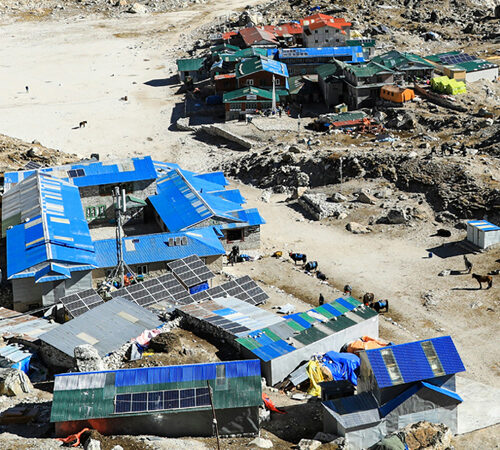
Today’s walk takes us to the end of the Manaslu Valley. The morning begins with a departure from Samdo, the final village of Gorkha and the high Manaslu areas. The route then heads towards the base of Larke-La Pass at Dharmasala, where we will find a few simple lodges for our overnight stay. It’s a lovely short walk on a pleasant, gradual path, with gorgeous scenery. The walk ends at the base of Larke-La Pass, where we will have lunch and spend our last night in the Gorkha district.

In the afternoon at Larke Phedi, you will have free time for a short walk and to prepare for the next morning’s long climb to the high Larke-La Pass and the journey towards the Manang area.


Trek Distance: 8.2km / 5miles
Highest Altitude: (3,875m / 12,713ft)/(4998m/16397ft)
Trek Duration: 3 to 4 hours

Day 12: Trek from Samdo (3,875m / 12,713ft) to Dharamsala (4,480m / 14,698ft)

We begin our trek along the Samdo edge, passing through fields and old Mani walls as we cross a wooden bridge over the Budhi Gandaki River. We will walk past the Athahra Saya River and then follow the Larke River. Along the way, you’ll notice the Mani walls and prayer flags, marking the proximity of the Larkya La Pass.

Next, we reach the Larkya Glacier, which is truly magnificent. After taking in the views, we continue our trek through the valley of Salkha Khola, gradually climbing to reach the stone guest house at 4,450 meters. This guest house is not a lodge but a community dormitory, known as a Dharamsala or Larkya La Phedi. This day will be memorable, offering stunning views of the Larkya Glacier and Mount Manaslu.

The big day has arrived! We start early, enjoying a hearty breakfast, and follow our lead guide as we begin the steep climb over moraine, rocks, and boulders around the ablation zone of the Larkya Glacier. Although the walk uphill is long, it’s enjoyable, with breathtaking views of Cho Danda and the nearby Larke Peak.

With steady progress and a few refreshing stops, we continue our climb to the top of Larkya La. The pass is marked with thousands of colorful Buddhist prayer flags. At the summit, a signboard displays the name of the pass and its exact elevation. We take some time to enjoy the fantastic panoramic views of Himlung, Cheo Himal, Kang Guru, Annapurna II, and the entire Manaslu range, with Ganesh Himal visible on the far eastern horizon.

After conquering the toughest part of the trek and standing at the highest point, surrounded by breathtaking mountain scenery, we begin our long descent to the other side of Larkya La Pass, into the Manang district.

From the base of Larkya La on the Manang side, we enjoy an easy walk through green forests and tall trees, leading to Bhimthang (also known as Bhimphedi) for an overnight stop after a long and challenging day. Bhimthang is nestled in a beautiful forested area with wide green fields and several good lodges, all adorned with prayer Mani walls.

The trail continues to descend through fields and Mani walls, crossing a wooden bridge over the Budhi Gandaki River. As we ascend, the fluttering prayer flags and Mani walls signal that we are nearing the top of the pass. After crossing two streams, we are treated to dramatic views of Larkya Glacier. The route then winds around the Salkha Khola Valley, ascending further to Dharamsala, also known as Larkya La Phedi.


Trek Distance: 11.7km / 7.2miles
Highest Altitude: (4,480m / 14,698ft)/(4460m/14633ft)
Trek Duration: 4 to 5                                                              


Day 13: Trek from Dharamsala (4,480m / 14,698ft) to Bhimtang (3,720m / 12,205ft) by crossing Larkya la Pass (5,160m /16,929ft)

The exciting part of the journey awaits us as we trek around the Manaslu Circuit, crossing the Larkya La Pass (5,100m). After an early morning breakfast, we will depart from Dharamsala, as it will be a long trek. Weather conditions are the most important factor, as the weather will determine whether the trek becomes more challenging due to strong winds or storms.

We begin by crossing the moraine and descending to a small lake. The trail becomes rough and unclear as we cross the south side of a steep grassy slope. Our route follows the moraine to an edge, marked by two landmarks. The prayer flags along the route help guide us, providing a sense of direction. We carefully descend to four frozen lakes, then climb a steep trail to the Larkya La Pass.

From the pass, you can enjoy panoramic views of Himlung Himal, Cheo Himal, Kang Guru, and the majestic Annapurna II. The marvelous trail continues along the top of the moraine, heading west with steep, rough bends. We cross the moraine again and gently descend to another grassy moraine at 4,450m. As we descend, the trail becomes easier to navigate, and we eventually arrive at a small meadow. The valley begins to widen as we approach a large meadow, mani walls, and small houses, indicating that we have reached Bhimtang.

It’s a big day. You will wake up early and begin trekking towards the top of the Larkya La. You may face strong winds and storms along the way. The trail is challenging and rough, involving walking on steep grassy slopes, passing moraine, and following the edge. The trail descends to the four frozen lakes and ascends to the top of the pass, where you will be rewarded with striking views of Mt. Manaslu, Himlung Himal, Mt. Kang Guru, and Mt. Annapurna II.

From here, you will gently descend to a small meadow. Beyond this point, the valley widens, passing by mani walls and small houses, leading to Bhimtang.

From Bhimtang, the rest of the journey is pleasant, with a downhill descent. As you lose altitude, you will feel rejuvenated upon reaching your goal. The walk continues through the cool shade of coniferous trees, with a few short climbs. However, the path mostly descends to Gho, where we will make an overnight stop. Gho is a small settlement with a few simple lodges, located at a cattle grazing area.


Trek Distance: 24.7km / 15.3miles
Highest Altitude: (5,160m / 16,929ft)/(5160m/16925ft)
Trek Duration: 7 to 8 hours

Day 14: Trek from Bhimtang (3,720m / 12,205ft) to Gho (2,550m / 8,367ft)

The previous day’s trek may have been tough, but you can rest assured that today’s trek will not be very taxing. You begin by descending to the Budhi Gandaki River and crossing it to enter the rhododendron forest. This leads to Karche, a cultivated area near the top of the Budhi Gandaki Valley. You will continue along the riverbank to reach Gho.

Next, you trek through more rhododendron forests and eventually reach Tilije. After crossing the Dudh Koshi River, you will walk through a scrub forest. The trail then descends to Dharapani, passing through small settlement areas.

On the last day of the adventure, the walk starts with an easy downhill stretch through a cool, dense forest, leading to the village of Telje. Telje is situated on a shelf above the Marsyangdi River, which flows from Manang, Annapurna Himalaya, and the Chulu glaciers.

After stopping for lunch in Telje, you’ll have a short climb in the afternoon, crossing a bridge to reach Dharapani for an overnight stop. Dharapani is a lovely, moderate-sized village located on a motorable road, at the junction of the popular Annapurna and Manaslu Circuit routes.


Trek Distance: 10km / 6.2miles
Highest Altitude: (3,720m / 12,205ft)/(1930m/6440ft)
Trek Duration: 7 to 8 hours

Day 15: Trek from Gho (2,550m / 8,367ft) to Dharapani (1,910m / 6,266ft)

This will be the last day on the trail. After waking up in Gho, we head towards Dharapani. The route descends, so the trek should be easy. You will pass through many fields and pastures, eventually reaching Tilje, a large Gurung settlement. This village is famous for its brandy. However, we continue forward, passing several Mani walls to reach Thonje village, and then enter Dharapani village.

From here, we will take a local jeep or bus back to Kathmandu. The drive goes through Besisahar and offers gorgeous views of the mountains and lush green hills. In the late evening, you will meet with the team members for a farewell dinner to celebrate the successful completion of the journey.

In the morning, from Dharapani, we embark on a long and exciting drive to Kathmandu. The ride takes you through the warm, lowland farming country, heading further down towards the Lamjung area. The drive continues with a long, winding descent to the bottom of a hill at Syange. From here, we follow the Marsyangdi River to reach Besisahar, a large town and the headquarters of the Lamjung district.

At Besisahar, we change transport, and the drive continues on a smooth, good road to Kathmandu. The journey follows a well-maintained road to Dumre town. From there, we take the main highway to Kathmandu, arriving by late afternoon or in the evening. Check into your hotel, and enjoy the rest of the evening at leisure for individual activities. We will then gather for a group farewell dinner.


Trek Distance: 6km / 3.7miles
Highest Altitude: (2,550m / 8,367ft)/(1400m/4593ft)
Trek Duration: 6 to 7 hours

Day 16: From Dharapani (1,910m / 6,266ft) to Besisahar (760m / 2,493ft) - then drive back to Kathmandu.

Today will be your last day on the road. After an early breakfast, we leave Dharapani and head to Besisahar by local bus, a journey that will take about six to seven hours. The drive will be scenic as we pass through many villages, along the Marsyangdi River, and through Bhulbhule town and Khudi. We expect to reach Besisahar before 3 pm to catch the last bus to Kathmandu. If we are delayed, we may need to extend the itinerary by a day.

Once we catch the bus to Kathmandu, we will pass the point where the Marsyangdi River meets the Trishuli River, as we head east along the Prithivi Highway. The drive offers beautiful and natural scenery, including terraced lands and high peaks.

It’s time to say goodbye and fly back home. Our airport representatives will assist you with check-out and drop you off at the international airport according to your flight departure time.

After an exciting and memorable adventure on the Manaslu Circuit Trek, on your last day in Nepal, our Trekking Planner staff and guide will transfer you to the airport for your flight back home or to your next destination.


Trek Distance: 224km / 139miles
Highest Altitude: (1,910m / 6,266ft)

Gears and Equipment

The exact clothing, equipment, and gear you need for the trek vary depending on the season. However, here is our recommended list. Please bring only the essentials. You can leave the rest of your belongings at our company store for free. We assign one porter for every two trekkers, and the luggage limit per trekker is 9 kg.

According to Himalayan trekking standards, the Manaslu Circuit Trek is a challenging trek in the Himalayas. It is recommended for experienced trekkers who are capable of walking 6 to 7 hours a day on rugged, steep paths. The Manaslu Circuit route explores a very remote area where resources are scarce. Accommodation is basic, and food options are limited. Therefore, flexibility is key to completing this trek.

Your adventurous Manaslu Circuit trek begins with a long scenic drive from Kathmandu to Baluwa Bazar, Gorkha. From Baluwa Bazar, you will start ascending through many small villages and dense forests, crossing several streams while enjoying beautiful waterfalls and stunning mountain landscapes. Along the route, you will pass through Baprak, Laprak, Singla, Philim, Deng, Namrung, Lho, Gham, Samagaon, and finally reach Dharmasala.

The region is rich in wildlife, which makes the journey even more exciting. You may encounter Himalayan tahr, yaks, and blue sheep. The area is also home to several ancient monasteries, gompas, and chortens, adorned with colorful prayer flags. From Dharmasala, you will trek to Bhimphedi, crossing the dramatic Larkya La Pass, and then descend to Chamje via Tilje, where this adventurous journey concludes.


Extra Items:

  • Camera/smartphone (with extra memory cards and batteries)
  • Extra batteries or rechargeable power bank (for charging devices)
  • Two-pin charging plug
  • Basic first aid supplies (band-aids, antiseptic wipes, pain relievers, Diamox)
  • Personal medications (inhalers, allergy medications, etc.)
  • A few passport-size photos
  • Passport photocopies
  • Notebook and pen
  • Binoculars
  • Swiss army knife or multi-tool (with scissors, can opener, etc.)
FAQs for Everest Base Camp Trek

Where is the Manaslu Circuit located?

The Manaslu Circuit is situated in the western Himalayan region of Nepal, near the border with Tibet. It encircles Mount Manaslu, the 8th highest peak in the world, offering trekkers an immersive experience of remote mountain landscapes and rich cultural heritage.

Manaslu Base Camp is located in the mid-western part of Nepal, between the Ganesh Himal and Annapurna ranges, at an altitude of 4,800 meters.

What is the best time of year to do the Manaslu Circuit Trek?

Spring (March-May) and autumn (September-November) are the best seasons, offering clear skies and moderate temperatures. From March to May and September to early November, most villages and lodges remain open. However, by mid-November, most will close as they migrate to lower, warmer areas to escape the winter cold.

What are the main highlights of the Manaslu Circuit Trek?

The Trek’s Main Highlights:

  • Spectacular views of Mount Manaslu (8,156m), Ganesh Himal, Annapurna II, and other peaks.
  • Crossing the challenging Larkya La Pass (5,160m), one of the longest passes in the Himalayas.
  • Passing through traditional Buddhist villages, adorned with monasteries, mani walls, and prayer flags.
  • The chance to explore diverse landscapes, from terraced farmlands and dense rhododendron forests to alpine meadows and glacier moraine trails.

What type of accommodation is available during the Manaslu Circuit Trek?

You will stay in tea houses or lodges with basic facilities. Some lodges offer attached bathrooms.


From$3,400$2,400
Book Now

Proceed Booking