Tsum Valley Trek with Manaslu Circuit Overview
The Tsum Valley and Manaslu Circuit trek circles Mount Manaslu, the world’s eighth-highest mountain, taking you across the Larkya La Pass (5,106m/16,751ft) while passing through several traditional villages and sacred Buddhist heritage sites. You’ll also explore Tsum Valley, located within the Manaslu Conservation Area, and home to the indigenous Tsumba community.
Trekking through the foothills of some of the highest mountains in the world is a dream for every avid trekker. While popular treks in the Everest and Annapurna regions attract many adventurers, the less-traveled routes offer a unique charm. The Manaslu Tsum Valley trek, organized by Nepal Eco Adventure, is an exceptional trekking experience.
Located in the lap of nature, Manaslu Tsum Valley is incredibly beautiful. The region’s breathtaking landscapes will captivate anyone who embarks on this remote trek. Known as “Beyul Kyimolung” in the local language, meaning the valley of happiness, Tsum Valley is a hidden gem that offers heavenly landscapes.
Trekking in this region has only been allowed since 2007, and its relative isolation adds to its mystique. This trek offers a rich cultural experience, showcasing centuries-old heritage and traditions. The diverse wilderness along the trail is a highlight, with magnificent views of snow-capped mountains visible from various points along the way.
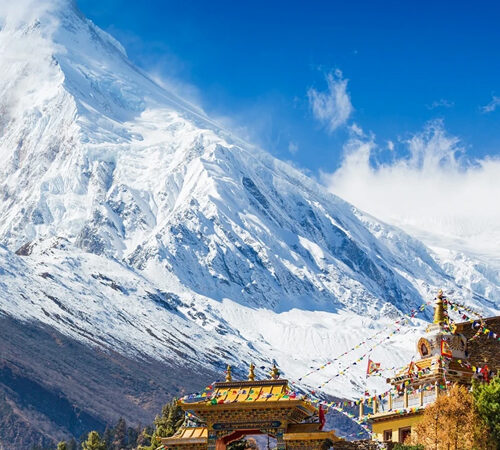
Mount Manaslu, towering at 8,163m, remains a prominent presence throughout the trek. Other notable peaks such as Himal Chuli, Buddha Himal, Shringi Himal, and Ganesh Himal also offer stunning vistas. The highest point of the trek is Larkya La Pass (5,213m). The challenging terrain requires a good level of fitness and stamina, as trekkers cross diverse landscapes at high altitudes.
The region is home to the Gurung, Bhotia, and Sherpa ethnic communities. Tibetan Buddhism plays a significant role, with numerous ancient gompas, chortens, and other religious landmarks along the trail. According to local beliefs, Milarepa and Guru Rinpoche (Padmasambhava) meditated in the caves of Tsum Valley.
Along the trek, you’ll encounter prayer flags, stones engraved with religious deities, symbols, and prayers, which reflect the strong influence of Tibetan Buddhism on local customs and lifestyles. Nepal Eco Adventure offers a comprehensive Manaslu Tsum Valley Trek package, with details on the best times to trek, itinerary, tips, and more. Happy traveling!
The Manaslu Tsum Valley Trek is a 19-day teahouse trek that brings trekkers close to Mount Manaslu (8,163m), the eighth-highest mountain in the world. It takes you through the secluded Tsum Valley, a region that was opened to the public in the mid-1990s, with the Tsum Valley section becoming accessible in 2008. This trek offers solitude and an opportunity to explore one of Nepal’s least-visited regions.
On average, trekkers will walk 7 hours a day. The trail reaches altitudes of around 3,000m, and with Larkya La Pass reaching 5,160m, proper acclimatization is essential. The terrain may include snow and ice, adding an element of difficulty. We will prepare you for these challenges.
The trail winds through cascading waterfalls, raging rivers, and steep bluffs, with many Gurung towns and terraced rice and millet fields. Along the way, you’ll cross suspension bridges, mani walls, chortens, and other Buddhist sites, particularly in Tsum Valley. The valley, often shrouded in mist, bears a strong resemblance to Tibet, with the Tibetan border nearby. Along the way, you might encounter Buddhist monks and nuns and visit sacred sites like Milarepa’s Cave.
Trekkers are likely to spot Nepal’s national bird, the Himalayan monal, found between 2,100m and 4,500m. The towering peaks of Manaslu, Simrang, Hiunchuli, Ngadi, Ganesh Himal, and Larkya Peak offer stunning views. From Larkya La, you’ll witness breathtaking vistas of icefalls, frozen lakes, Himlung Himal, Cheo Himal, Kangguru, and the majestic Annapurna II.
This trek is perfect for those looking for an off-the-beaten-path adventure. It’s tough but incredibly rewarding.
This shorter version of the Manaslu and Tsum Valley Trek takes you through sacred, hidden valleys beneath Mount Manaslu and Ganesh Himal. In less than 20 days, you’ll explore Tsum and Nubri Valleys, areas rarely visited by tourists.
The trek begins with an exploration of Tsum Valley, a sacred valley for Tibetan Buddhists, blessed by the Second Buddha and saint Milarepa. Known as a “beyul” or hidden Buddhist paradise, Tsum Valley opened to tourists in 2008.
Before entering the Tsum Valley, you’ll pass through charming Hindu villages of the Gurung community and lush tropical forests along the Budhi Gandaki River. From Lokpa, you’ll trek through Lower and Upper Tsum villages, visiting ancient monasteries and meditation caves along the way. You’ll learn about the fascinating culture of the Tsombas, the valley’s inhabitants.
Visits to Mu Gompa and Rachen Gompa will provide insight into monastic life, while a night at the Rachen Nunnery will allow you to observe the lifestyle of Buddhist nuns.
The Tsum Valley is an untouched region in the western-central part of Gorkha district, nestled within the Manaslu trekking area of Nepal’s Great Himalayan Trail. The valley is populated by the Tamang and Tibetan people, who settled here before the 16th century.
The region is relatively unexplored compared to other popular trekking destinations in Nepal, offering an authentic experience of Tibetan Buddhist culture, traditions, and customs. The trek includes thrilling high passes, remote landscapes, stunning snow-capped peaks, natural hot springs, beautiful suspension bridges, and untouched wildlife. You’ll also witness the unique architecture of old monasteries, rhododendron and oak forests, and cascading waterfalls.
The best times to trek the Manaslu Tsum Valley are from March to May and September to November. This trek is classified as moderate, requiring trekkers to have good physical fitness. On average, you’ll trek for 5-6 hours per day.
You can choose between a camping or teahouse trek, depending on your preferences. Since the Manaslu Tsum Valley trek takes place in a restricted area, it requires special permits, and we will arrange everything for you.
The Manaslu and Tsum Valley trek combines the well-known Manaslu circuit with the secluded Tsum Valley, offering an unforgettable trekking experience. With its dynamic mountain vistas, dramatic landscapes, and rich Tibetan-influenced culture, this trek is perfect for those looking for an immersive adventure in solitude.
Marvel Adventure organizes fully guided 19-day Manaslu and Tsum Valley Treks with a carefully designed itinerary. Contact us for more information and to book your adventure in the Himalayas.
Day 1:
Drive from Kathmandu via Arughat to Soti Khola
Maximum Altitude: (1,300m /4,264 ft)
Trekking duration: 6 to 7 hours
Day 2:
Trek from Soti Khola to Machha Khola
Maximum Altitude: (890m / 2,965ft)
Trekking duration: 7 to 8 hours
Day 3:
Trek from Machha Khola to Jagat
Maximum Altitude: (1,400m / 4,593ft)
Trekking duration: 7 to 8 hours
Day 4:
Trek from Jagat to Lokpa
Maximum Altitude: (2,040m / 4,493ft)
Trekking Duration: 5 to 6 hours
Day 5:
Trek from Lokpa to Chumling (called Lower Tsum)
Maximum Altitude: (2,386m / 6,692ft)
Trekking Duration: 5 to 6 hours
DAY 6:
Trek from Chumling to Chhokangparo
Maximum Altitude: (8.4km / 5.2miles)
Trekking Duration: 5 to 6 hours
DAY 7:
Trek from Chhokangparo to Nile via Milarepa Piren Phu Cave
Maximum Altitude: (3361m / 11,026ft)
Trekking Duration: 4 to 5 hours
DAY 8:
Trek from Nile to Mu Gompa
Maximum Altitude: (3,700m / 11,026ft)
Trekking Duration: 3 to 4 hours
DAY 9:
Mu Gompa to Chhokangparo
Maximum Altitude: (3,240m / 10,629ft)
Trekking Duration: 6 hours
DAY 10:
Trek from Chhokangparo to Chumling
Maximum Altitude: (3,010m / 9,903ft)
Trekking Duration: 6 to 7 hours
DAY 11:
Trek from Chumling to Deng
Maximum Altitude: (2,386m / 7,827ft)
Trekking Duration: 6 to 7 hours
DAY 12:
Trek from Deng to Namrung
Maximum Altitude: (2,900m / 9512ft)
Trekking Duration: 6 to 7 hours
DAY 13:
Trek from Namrung to Sama Gaon
Maximum Altitude: (3,530m / 11,581ft)
Trekking Duration: 8 to 9 hours
DAY 14:
Rest day in Sama Gaon (3,530m / 11,581ft)
Maximum Altitude: (3,530m / 11,581ft)
Duration: 3 to 4 hours
DAY 15:
Trek from Sama Gaon to Larkya La Phedi (Dharma sala)
Maximum Altitude: (4,460m / 14,632ft)
Duration: 5 to 6 hours
DAY 16:
Trek from Dharamsala to Bhimtang by crossing Larkya la Pass
Maximum Altitude: (5,160m / 16,929ft)
Duration: 7 to 8 hours
DAY 17:
Trek from Bhimtang to Gho
Maximum Altitude:(3,720m / 12,205ft)
Duration: 4 to 5 hours
DAY 18:
Trek from Gho to Tal
Maximum Altitude: (2,550m / 8,367ft)
Duration: 4 to 5 hours
DAY 19:
Drive from Tal to Besisahar then Kathmandu
Maximum Altitude: (1,700m /5,577ft)
Duration: 9 to 10 hours
After an early breakfast, we will begin our journey with a drive along the Prithvi Highway, heading west from Kathmandu. The scenic ride offers views of terraced farms, rushing rivers, charming villages, and dense forests.
We will cross the Trishuli River to reach Dhading Bensi, then continue to Arughat. As we drive through picturesque villages, we’ll follow the Dorandi Khola northward to Gorkha. From the road, you’ll enjoy stunning views of Manaslu and Ganesh Himal. However, our destination is still a two-hour drive away from Arughat, leading us to Soti Khola.
Upon arrival, you will be picked up from the airport and transferred to your hotel. If time permits, we will guide you around Thamel and help you purchase any necessary equipment for your trek. Look for our Treks and Expeditions placard. After checking into your hotel, your trekking guide will be introduced, and we will ensure all necessary arrangements are made. In the afternoon, enjoy a stroll through the colorful tourist market in downtown Thamel.
The trek begins with a short drive from Kathmandu to Machhakhola. You will travel through a variety of landscapes in the hilly region to reach the starting point of the trek.
After breakfast, you will pack your bags and board the bus. We will head out, following the scenic route along the Prithvi Highway to Malekhu. From there, we’ll drive through the Trishuli River area towards Dhading, approximately 30 km away.
The road conditions can be bumpy, but the drive is scenic, passing through Arughat and reaching Gola Bhanjyang. Along the way, you’ll be enchanted by breathtaking views of snow-capped mountains, including Ganesh Himal and Mt. Manaslu.
The journey continues on narrow, cliffside roads to Soti Khola, a beautiful settlement with fantastic views of the mountains. From there, it’s another 1.5 to 2-hour drive to Machhakhola. Once you arrive, you can explore the region and enjoy the stunning views of the snow-capped peaks.
After settling into your lodge and having dinner, you’ll rest overnight. Your Manaslu and Tsum Valley adventure will begin with a scenic drive from Kathmandu to Machhakhola, following breakfast. The drive takes you through diverse landscapes—from lush green hills to deep valleys, rivers, waterfalls, and vibrant settlements along the Prithvi Highway. You will reach Malekhu during the first part of the drive.
Continuing through Dhading, Arughat, and Gola Bhanjyang along the Trishuli River, you will eventually turn onto the trails leading to Soti Khola. From there, it’s about 1.5 to 2 hours to Machhakhola. Throughout the drive, you’ll be treated to spectacular views of the Himalayan massifs, including Manaslu, Ganesh Himal, and other nearby peaks.
Trek Distance: 160km / 99.4miles
Highest Altitude: (1,300m /4,264 ft)
Trek Duration: 6 to 7 hours
We continue our trek, following the low valley to the north, occasionally stopping to admire the majestic Himalayan peaks. As we hike up the picturesque, densely forested Budhi Gandaki Valley, the route passes through several small villages until the valley begins to widen. On the opposite side of the valley, you’ll see a large stream flowing into the Budhi Gandaki River. Continuing our journey, we reach the beautiful village of Lapubesi (880m). From Lapubesi, we descend along a meandering path to reach Macha Khola.
Today, we drive from Kathmandu to Soti Khola, passing through Dhading Beshi and Arughat. The road becomes rough and bumpy from Dhading to Arughat. In the afternoon, we follow a trail through the woods, heading upriver along the banks of the Budhi Gandaki River. The path takes us across the mountains, offering frequent views of the river far below. Tonight, we will stay at a guesthouse in Machha Khola.
The bus ride from Kathmandu to Machha Khola spans 130-150 km and takes between 7-12 hours. You can choose between local buses, which are budget-friendly but often crowded, and private tourist buses, which offer more comfort but at a higher cost. The road can be bumpy and winding, especially outside of Kathmandu. Buses depart from the New Bus Park. Be sure to bring water, snacks, and a jacket. Prepare for possible delays and enjoy the scenic drive through Nepal’s hills.
The next day, we will continue our trek from Machha Khola to Jagat. We’ll pass through narrow trails, then cross Tharo Khola. After hiking for several hours, we’ll reach the village settlement of Khola Besi, and then arrive at Tatopani. Tatopani is famous for its hot springs, where you can relax and enjoy the soothing atmosphere.
After exploring the region, we’ll continue trekking through beautiful landscapes, including a ridge offering stunning views. We will cross the Budhi Gandaki River via a suspension bridge, then climb uphill on a stony path, crossing a landslide area and a ridge to reach Doban. After crossing another suspension bridge, we will descend and follow the road near the river before climbing again to reach Thado Bharyang.
From here, we’ll travel along the west bank of the Budhi Gandaki River, climb over a ridge, and arrive at the village of Jagat. We’ll rest at a lodge or teahouse.
Switching from the previous day’s driving adventure, Day 2 of your Manaslu and Tsum Valley Trek begins with a beautiful trek alongside the Budhi Gandaki River. The trail ascends and descends through lush hills. Along the way, you’ll pass the charming village of Khola Besi, eventually making your way to Tatopani, a natural hot spring destination with cultural and religious significance.
On the final stretch of the day, we’ll cross a suspension bridge over the Budhi Gandaki River and ascend a rocky trail to reach Doban. After crossing a second suspension bridge over the Yaru Khola, we’ll continue up the trail, overcoming a climb to Thado Bharyang. From there, we’ll reach the ridge that leads us to Jagat, a beautiful Himalayan settlement that marks the entrance to the Manaslu Conservation Area.
Trek Distance: 9.7km /6miles
Highest Altitude:(1400m)/(890m / 2,965ft)
Trek Duration: 6 to 7 hours
We cross the Tharo Khola River and head upstream to Khola Beni. The route takes us along dramatic gorges with waterfall-sculpted rocks and occasional landslides. After crossing a bridge, we reach the small village of Kholabesi and then continue to the natural hot springs at Tatopani (which means “hot water” in Nepali).
From the hot springs, we follow another trail and cross the Budhi Gandaki River on a suspension bridge. We’ll walk past a landslide and reach the village of Doban. From Doban, we cross a suspension bridge over the Yaru Khola and climb stone stairs to Thado Bharyang before ascending to the charming village of Jagat. Jagat is the entry point to the Manaslu Conservation Area, where we will register our permits at the police checkpoint.
Today, we cross the Machha Khola River and pass Khorlabesi (920m) before arriving at Tatopani, famous for its therapeutic hot springs. The trail then passes through a forested area as we make our way to Dovan Khola (river) and onward to the Budhi Gandaki Valley. As we gain elevation, you will notice a change in vegetation until we reach Jagat Village, where we will stay at a guesthouse overnight.
Your trek from Machha Khola to Jagat is a rewarding challenge, covering 22 km with a 450m elevation gain, typically taking 7 to 8 hours. The route includes a mix of forest paths, riverbanks, and rocky sections, with some steep ascents. Starting early is important to manage the distance. Be sure to carry ample water and energy snacks, pace yourself, and be prepared for changing weather. Jagat offers basic lodges and a glimpse into local culture—enjoy the journey!
We will continue our trek from Jagat, crossing challenging terrain to reach the village settlement of Lokpa. The trail climbs through rugged landscapes and ravines, offering majestic views of the awe-inspiring Sringeri Himal and other snow-capped peaks. After trekking for about 6-7 hours, we will reach Lokpa at 2249m and spend the night in a lodge.
After entering the restricted area of the Manaslu region, the day begins with a climb up a ridge to Salleri. We’ll continue along the riverbanks of the Budhi Gandaki River, crossing a long suspension bridge toward Philim. Following this route, we’ll reach Ekle Bhatti, where the trails diverge toward the Tsum and Manaslu regions.
Next, we’ll follow the trail toward Lokpa village, passing several other high Himalayan settlements. We’ll stay on the right side of the Tsum Valley to reach Lopka Village. The trek will take us through scenic landscapes, with views of the Syar River and the stunning Himalayan ranges, including Boudha Himal, Himalchuli, Sringeri Himal, and Ganesh Himal.
Trek Distance: 22km / 13.7miles
Highest Altitude: (1,400m / 4,593ft)
Trek Duration: 6 to 7 hours
We enter the restricted region of Manaslu by climbing a ridge to Salleri. From here, we walk along the riverbanks, crossing the Budhi Gandaki River on a long suspension bridge. As we continue, the valley widens toward Philim. Passing Ekle Bhatti, the trail splits: one path leads to Tsum, and the other to Manaslu.
We hike uphill toward Lokpa, passing several villages along the way. The rivers become narrower, and we catch a glimpse of the confluence of the Syar Rivers from Tsum Valley. We continue trekking on the right side of Tsum Valley to reach Lokpa village, the first settlement in Tsum Valley that offers clear views of the Manaslu range. Lokpa is a hidden valley, blessed by Padmasambhava centuries ago. (Padmasambhava is one of the founding figures of Tibetan Buddhism.) From Lokpa village, you can enjoy stunning views of Himalchuli and Boudha Himal.
Today’s trek lasts 6 hours, starting with a hike to Salleri, where we’ll be rewarded with magnificent views of Mount Sringi. We then descend to Sirdibas, a traditional Buddhist village. The trail continues until we reach Lokpa, just north of Philim. We pass through Ekle Bhatti and climb to a ridge along a pine forest trail. At a junction, we take the path toward Tsum Valley. We’ll spend the night at Lokpa.
The trek from Jagat to Lokpa covers 22 km with a 900m elevation gain, taking 7 to 8 hours. Expect a steep ascent through lush forests and terraced fields. The trail includes rocky paths, river crossings, and offers stunning mountain views. Pass through picturesque villages to experience local culture. Start early, stay hydrated, carry high-energy snacks, and be prepared for variable weather. Lokpa offers a peaceful rest spot with basic lodgings—enjoy the beautiful scenery!
Today’s trail takes us from Lokpa to Dumje. We’ll trek from Lokpa, climbing a beautiful ridge leading to Ganesh Himal Base Camp. The view of the entire Himalayas from here is breathtaking.
Next, we trek to Chumling from the base camp, where you’ll get the best views of the Shangri Himal, just above the village settlement. The trail continues through various territories, eventually leading to Dumje, where we’ll stay overnight at a lodge and rest for the evening.
Day 4 of the Manaslu and Tsum Valley Trek is an adventurous one, as we begin our exploration by following the ridge from Ganesh Himal Base Camp, leaving Lokpa behind. This day’s trek offers enchanting views of the Himalayan peaks as we make our way toward Chumling. Descending into the Lungwa River Valley, we’ll trek through a dense subtropical forest of rhododendrons and pine trees. The solitude of the empty trail is a peaceful contrast to the civilization behind us, until we reach Chumling from Lokpa.
We will cross Syar Khola to reach Chumling, then continue ascending toward Dumje, located above Chumling, also known as ‘Lower Tsum Valley.’
Trek Distance: 17.5km / 10.8miles
Highest Altitude: (2,040m / 4,493ft)
Trek Duration: 6 to 7 hours
After breakfast, we begin our trek from Lokpa Village, the wild gateway to Tsum Valley. On a clear day, you’ll be rewarded with stunning views of Baudha Himal (6672m) and Ganesh Himal VI as you travel from Lokpa to Chumling.
The trail first descends into the Lungwa River Valley before climbing up through a subtropical forest of dense rhododendron and pine. There are no villages between Lokpa and Chumling. We’ll cross the Syar Khola to reach Chumling. A side trip to the upper parts of Chumling will lead you to a monastery, from where you can enjoy panoramic views of Ganesh Himal. Chumling is home to a health post and three monasteries: Panago Gumba, Mani Dhungyur, and Gurwa Gumba.
Today, we have a 5-hour trek ahead of us to Tsum Valley. As we descend to the Chumling Village, the first sights of Tsum Valley will appear. From there, we’ll climb to Ripchet and soon arrive at the authentic Buddhist village of Chumling, known for its ancient monastery, traditional Tibetan-style houses, prayer flags, mani walls, and stone-paved streets. We’ll stay overnight in Chumling.
Today’s trek from Lokpa to Chumling covers 6.4 km with a 146m elevation gain, taking 4 to 5 hours. The path involves a gradual ascent through forested trails and terraced fields, with some rocky and potentially muddy sections. Along the way, you’ll enjoy beautiful views of hills and valleys, passing through scenic villages offering glimpses of traditional life. Start with a hearty breakfast, take your time to enjoy the surroundings, stay hydrated, and be prepared for changing weather. Chumling offers a peaceful retreat with basic lodgings, making it a perfect place to relax and acclimatize. Enjoy the serene atmosphere and stunning views!
After breakfast, we will trek to Chule for 7 hours. This trek will take us through the beautiful Upper Tsum Valley as we pass through several villages. The Shiar Khola River lies to the east of Nile village, just an hour away from Chule.
The trail leads us to Tsum, where we’ll observe the Piren Phu cave. The village settlement is near Burji Village, located at the foot of a rocky cliff. Along the way, you’ll be captivated by views of Shiar Khola, Rachen Gompa, and extensive farmlands terraced into the hills. Upon reaching Nile Chule, we’ll rest and prepare for our next journey along the trail.
Today’s trek follows the Upper Tsum Valley trail as we make our way toward Nile, which lies on the western side of the Sikhar Khola. From Nile, it’s just a 20-minute ascent to Chule, the last settlement in the Upper Tsum Valley. As we pass through Bgakyu Leru, you’ll see farmers working on their fertile fields.
Continuing on, we’ll pass Lamagaon before arriving at the Milarepa Piren Phu Cave, located near Burji Village at the base of a rocky cliff. During the final stretch, we’ll cross the Shiar River to reach the village of Nile.
Trek Distance: 6.3km / 3.9miles
Highest Altitude: (2,386m / 6,692ft)
Trek Duration: 5 to 6 hours
Today, we enter the upper valley, which is part of the inner Himalayas. The trail continues along the Syar River, leading us down to Domje, the largest settlement in the Tsum Valley. From Domje, we climb uphill to reach Chhokangparo. On a clear day, you’ll enjoy magnificent views of Himalchuli and Ganesh Himal from Chhokangparo. Here, you’ll also have the chance to experience the hospitality of the local Tibetan “Tsombo” people, along with traditional Tibetan Chiya (butter tea) and local meals.
Today’s trek begins with a 5-hour journey, starting with crossing a suspension bridge, where you can take in amazing views of Ganesh Himal. The trail continues, taking us past Rainjam and crossing the Seru Khola before arriving at Gho Village. After a total of 5 to 6 hours of trekking, we’ll reach Chhokangparo Village, where we’ll have stunning views of Himalchuli (7893m) and Ganesh Himal (7140m). We’ll stay here overnight. Breakfast, lunch, and dinner are included.
The trek from Chumling to Rachen Gompa, part of the Manaslu Circuit, takes 6 to 7 hours over 6.2 kilometers. At an altitude of 3,240 meters, altitude sickness can be a concern, so it’s important to stay hydrated and monitor your health. The terrain includes steep ascents and rocky paths, so trekking poles can be helpful. Since mountain weather can change quickly, it’s important to dress in layers. Rachen Gompa is a significant monastery and provides a wonderful opportunity to immerse yourself in local culture—be respectful of customs and enjoy the spiritual atmosphere. If you’re staying overnight, check for available lodges or guesthouses. Make sure you have the necessary permits and follow local regulations for a smooth trek. Enjoy the breathtaking landscapes and cultural richness of the area!
Today’s trek begins from the village settlement of Nile Chule as we head toward Mu Gompa. This uphill hike takes us to the largest gompa in the region, located at the highest point of the Tsum Valley.
The beautiful 18th-century monastery is home to a collection of religious texts, including the Kangyur, and features life-size statues of Tara, Avalokiteshwara, and Guru Padmasambhava. The trek to Mu Gompa takes a few hours to complete, and once we arrive, we’ll spend the night at a teahouse.
Day 6 of the Manaslu and Tsum Valley Trek will focus on exploring the cultural and religious heritage of the region. Starting early, we’ll follow the trail along the west bank of the valley, close to the Tibetan border, on our way to Mu Gompa—the largest monastery in the region. The trek offers breathtaking views of the Himalayas and takes around 3 to 4 hours.
Upon arrival at Mu Gompa, home to the Kangyur and statues of Tara, Guru Padmasambhava, and Avalokiteshwara, you’ll also have the opportunity to explore another ancient monastery in the Tsum Valley, Dhephu Doma Gompa.
Trek Distance: 8.4km / 5.2miles
Highest Altitude: (2,386m / 6,692ft)/(3,010m / 9,875ft)
Trek Duration: 5 to 6 hours
Today, we walk a relatively shorter distance. The Nile, located on the western side of the Shikhar Khola, is just a 20-minute walk from Chhule, the last village in the northern upper Tsum Valley. As you reach Ngakyu Leru, you’ll notice the fertile land where people are farming.
After passing Lamagaon, we’ll reach St. Milarepa Piren Phu Cave, where his footprint is said to be preserved in the rock. Piren Phu (Pigeon Cave) is one of the most sacred caves in the Tsum Valley. The cave is home to two separate Gumbas, and it features richly painted Buddhist murals, beautifully carved stone scripts, long prayer flags, and significant Buddhist manuscripts. This makes Piren Phu Cave one of the most important socio-cultural landmarks in the valley. After visiting the cave, we’ll cross a suspension bridge over the Shiar River and continue our trek through several villages to arrive at Nile.
Today’s trek takes 6 to 7 hours, following the trail to Rachen Gompa and then along the Shiar Khola (river). After leaving the river, we’ll pass through the villages of Phurbe and Pangdun before reaching Nile, where we will stay for the night. Mu Gompa, the largest monastery in the region, is located at the highest point in the Tsum Valley. Breakfast, lunch, and dinner are included.
The trek from Rachen Gompa to Mu Gompa via Nile is a highlight of the Manaslu Circuit, covering 12 kilometers in 6 to 7 hours. At an altitude of 3,700 meters, Mu Gompa requires proper acclimatization, so it’s important to monitor for altitude sickness and stay hydrated. The trail includes significant elevation gain with rocky and uneven terrain, making trekking poles beneficial. Prepare for unpredictable mountain weather by wearing layered clothing to handle cold, rain, or snow. Along the way, you’ll be treated to stunning views of the Himalayas and unique landscapes. Mu Gompa, with its rich cultural heritage, is well worth exploring—be sure to respect local customs. Check in advance for availability at lodges or guesthouses in Mu Gompa, and ensure you have the necessary permits and are adhering to local regulations. Enjoy the breathtaking journey!
Day 7 is set aside for acclimatization and exploration. You’ll have the opportunity to explore the beautiful landscapes surrounding Mu Gompa. The region’s serene beauty will captivate you, with small chortens, mani walls, and other Buddhist landmarks enriching your experience.
You can also take a short hike around the area, perhaps venturing to the base of Pika Himal. From this viewpoint, you’ll enjoy enchanting views of the snow-capped mountains and surrounding landscapes, including a view of the Tibetan region across the border. The Ganesh Himal is especially stunning from here. After exploring and acclimatizing, we will return to Mu Gompa for the night.
As it’s recommended to acclimatize properly after reaching elevations above 2,500 meters, Day 7 of your Manaslu and Tsum Valley Trek will serve as your first acclimatization day. Begin your day with a morning hike around the region, where you can explore the beautiful landscapes influenced by Tibetan culture and traditions.
After discovering some of the region’s major highlights, you’ll spend the night in Mu Gompa, preparing for the adventure ahead.
Trek Distance: 9.7km / 6miles
Highest Altitude: (3361m / 11,026ft)
Trek Duration: 4 to 5 hours
A short walk from Nile along the west bank of the valley, close to the Tibetan border, leads to Mu Gompa—the highest point of the Tsum Valley Trek. We hike through yak pastures and typical dry, arid trans-Himalayan terrain. The Mu Gompa monastery is surrounded by rows of chortens and offers beautiful mountain views. Additionally, you’ll have the opportunity to visit Dhephu Doma Gompa, one of the oldest monasteries in Tsum. From the Gompa, the descent begins. We descend to Rachen Gompa, then continue to Chhule, and finally reach Phurbe. Rachen Gompa lies in the border area between Nepal and Tibet, surrounded by towering mountains. Our destination for the day takes us through a forested area, ultimately reaching Chhokangparo.
Your trek from Nile to Chumling is a captivating journey through the Manaslu and Tsum Valley regions. After passing through Chhule and Phurbe—where you can stay in a Sherpa home—you’ll continue towards Rachen Gompa, a nunnery with spectacular views of Kipu Himal on clear days. The path follows the Siyar River, passing through flat meadows and areas with power lines. As you trek through Chhokangparo, Domje, Kowo, and Tanju, the trail will eventually lead you to Chumling for the night. The 12 km trek from Nile to Chumling involves a 6 to 7-hour descent from 3,361 meters to 2,386 meters, with diverse terrain and steep descents. Proper trekking shoes and careful navigation are essential to protect your knees. With lush forests and stunning Himalayan views, make sure to carry sufficient water, snacks, and gear. Confirm accommodation options in Chumling in advance. Enjoy the trek and the breathtaking scenery! If you need more advice, feel free to ask.
Today’s trail takes you from Mu Gompa to Rachen Gompa. The path passes through beautiful landscapes to reach the nunnery, located in the Shiar Khola Valley. This large village settlement in the Tsum Valley is home to nuns of the Ngak-Pa sect. Trekkers can find 1,000 Avalokiteshvara statues on the premises, adding to the enchantment of the site. After arriving at Rachen Gompa, we will rest for the day and prepare for the next day’s trek.
This day’s adventure is slightly easier as you leave behind Mu Gompa and descend toward Rachen Gompa, another important religious hub in the Tsum Valley. Following the trails along the Siyar Khola, you’ll arrive at the nunnery located in the Shiar Khola Valley. Rachen Gompa, situated on the border between China and Nepal, is one of the largest settlements in the Tsum Valley. It houses nuns from the Ngak-Pa Sect, and you’ll be enchanted by the 1,000 Avalokiteshvara statues at the Gompa premises.
Trek Distance: 7.9km / 4.9miles
Highest Altitude: (3,700m / 11,026ft)
Trek Duration: 3 to 4 hours
From the Gompa, the descent begins. We descend to Rachen Gompa, then continue to Chhule before reaching Phurbe. Rachen Gompa lies on the border between Nepal and Tibet, surrounded by towering mountains. The day’s journey takes us through a forested area, ultimately reaching Chhokangparo. After breakfast, we continue descending from Chhokangparo until we reach Gho. We will cross a suspension bridge near Gho and hike onward to Rainjam Village. From Rainjam, we descend into Tsum Valley and finally reach Chumling, our destination for the day.
After crossing the suspension bridge, we begin a long descent from Chumling to Lokpa village. The trek starts on a rocky hill with views of Sringi Himal and continues along the Shiar Khola riverbank. Expect stunning vistas of Ganesh Himal, Manaslu, and other peaks. The path leads past Ghatta Khola, through farms growing maize, millet, and vegetables, and includes bamboo forests. We will cross the Deng River after traversing an empty canyon, following the bank of the Budhi Gandaki. Covering about 15 km in 8 to 9 hours, with a descent from 2,386 meters to 1,860 meters, this trek will take you through varied terrain and changing weather. Accommodation in Deng is limited, so be sure to book early.
The trek from Rachen Gompa to Chumling is an important segment of the journey. This section is challenging, as you will trek for approximately 7-8 hours at varying altitudes, including both uphill and downhill stretches. After some time on the trail, you will reach the large settlement of Chumling, where you will rest for the night at a local lodge.
Today’s trek is a long adventure. Leaving the nunnery behind, you will head toward Chumling, passing through both high and lower elevation points. Descending from Chhokangparo, you will continue along the trail, heading toward Gho. The wide Himalayan vistas of this day’s trek make the experience truly exhilarating.
Moving further, we will cross a suspension bridge near Gho and push onward to Rainjam Village. From here, the path descends into Tsum Valley, and we will finally arrive at Chumling, following the downward trail. After a long and tiring trek, you can enjoy delicious local delicacies and warm hospitality at the lodge in Chumling.
Highest Altitude: (3,240m / 10,629ft)
Trek Duration: 6 hours
Our descent from Chhokang Paro continues as we reach Gho. We will cross a suspension bridge near Gho and then hike onward to Rainjam Village. After leaving Rainjam, we will descend into Tsum Valley and finally reach Chumling, our destination for the day.
Today, we have a 6 to 7-hour trek ahead of us as we descend from Chumling to Lokpa, starting with crossing a suspension bridge. The trail follows a rocky ridge with excellent views of Sringi Himal. We will then pass through Ghatta Khola, passing by farms growing maize, millet, potatoes, and vegetables. As we continue, the trail follows the bank of the Budhi Gandaki, passing through a bamboo forest before reaching the Deng River. Tonight, we will stay at Deng, next to the river.
On this day of your Manaslu and Tsum Trek, you will journey from Deng to Namrung, covering 19 km in 6 to 7 hours. The trek begins with a climb from Deng to Rana Village and continues to Bhiphedi. Along the way, enjoy spectacular views of Sringi Himal and several crossings of the Budhi Gandaki River. The trail meanders through valley canyons, passing the Serang Khola, before reaching Ghap. After Ghap, the ascent steepens as we pass through bamboo and rhododendron groves.
After crossing a few wild rivers, we will reach Namrung Village, the gateway to Upper Nuri, where Tibetans speak a distinct dialect. Starting at 1,860 meters in Deng and ascending to 2,630 meters in Namrung, expect significant altitude gain and varied terrain, including steep climbs. The trek offers lush forests, terraced fields, and traditional villages with stunning peak views. Pace yourself, stay hydrated, and dress in layers for changing weather. Namrung offers a unique cultural experience and warm hospitality. Be sure to have sufficient supplies for the journey.
On this day, we will start our trek from Chumling to Deng, passing through various terrains. The trail offers majestic views of Ganesh Himal, Manaslu, and other snow-capped mountains in the region. There are several gorges in the area that you’ll need to climb through before stopping for lunch. Afterward, you’ll continue on descending trails that cross the Budhi Gandaki River.
There are several bridges to cross as you move from the west to the east bank of the Budhi Gandaki River. The trail passes through dense forests before reaching the Deng Khola. After crossing the river, we will rejoin the main path and arrive at Deng. We will stay at a teahouse in Deng for the night.
On Day 10 of your Manaslu and Tsum Valley Trek, the trail descends from Chumling to Deng. This is a relatively easier day’s trek as you follow the banks of the Shair Khola, heading towards Lokpa Village during the first segment. On a clear day, you’ll pass large flocks of Himalayan sheep and goats grazing on the hills as you continue your descent toward the Budhi Gandaki River.
With stunning views of Ganesh Himal, Manaslu, and other peaks in the Himalayan range, you will cross several gorges. The sturdy bridge over the Budhi Gandaki River leads you through narrow gorges with several ascents and descents. During the final stretch, you’ll cross a suspension bridge toward Nupri, passing through a scenic bamboo forest trail before arriving at Deng, a beautiful Gurung settlement.
Highest Altitude: (3,010m / 9,903ft)
Trek Duration: 6 to 7 hours
Today, you will leave Chumling and begin your descent, making it a relatively easier journey. You’ll follow the bank of the Shair Khola to reach Lokpa Village. On a clear day, you may pass through large flocks of sheep and goats along the path.
After Lokpa, the trail continues its descent as we cross the Budhi Gandaki River on a sturdy bridge. The path then enters a narrow gorge, where it starts to ascend and descend while gradually climbing through the valley. We’ll cross another river on a suspension bridge to reach Nupri, and then pass through bamboo forests to arrive at the Gurung village of Deng (1860m).
Today begins with a steep climb before we descend back to the Budhi Gandaki River. The trail continues through the valley, passing several small settlements. As we approach Namrung, you’ll notice Mani stones—stones engraved with Tibetan mantras—marking our entry into a region with strong Tibetan Buddhist influence. In the afternoon, we’ll take a short detour to visit Prok village (a 2-hour round trip) before continuing to Namrung for an overnight stay at a guesthouse.
The trek from Namrung to Lho spans 11 km and takes 4 to 5 hours, with an ascent from 2630 meters in Namrung to 3180 meters in Lho. The path rises steeply from Namrung, offering spectacular views of Himal Chuli and Ganesh Himal. The trail then descends to the Simnang side valley and the Hinang River, where Ngadi Chuli becomes visible from a chorten. After crossing the river, we continue to Sho and ascend to Shrip, where a large prayer wheel marks the way.
The climb to Lho is challenging, but the views of Manaslu North and Naike Himal are worth the effort. Lho is home to Ribung Monastery, and nearby Kani offers stunning sunset and sunrise views. The trek features a mix of gradual and steep ascents through lush forests and terraced fields. Be sure to carry adequate water, snacks, and layered clothing for varying weather conditions. Confirm lodging in advance, and pace yourself to acclimatize to the altitude while soaking in the breathtaking scenery and cultural experiences.
We begin today’s trek from Deng to Namrung, climbing uphill on a cliff before descending briefly to reach the Budhi Gandaki River, which we will cross on a suspension bridge. After crossing, we climb along the western side of the Budhi Gandaki Valley.
The forested trail offers excellent opportunities for natural exploration, and you’ll encounter numerous Mani stones and Buddhist landmarks, adding cultural significance to the journey. As we move forward, we’ll cross several sections of the trail before reaching Ghap. We’ll then pass through Prok village, where you can enjoy some of the best views of Siring Himal.
We’ll cross the river several times, passing through forested trails and other Gompas. After crossing the river again, the trail flattens out before making the final climb into Namrung village, where we’ll spend the night. The viewpoint in Namrung offers incredible views of Ganesh Himal, Siring Himal, and Mt. Himal Chuli.
Today’s trek begins with an uphill ascent, followed by a short descent that leads us to the Budhi Gandaki River. Leaving Deng behind, we’ll head toward Rana (1,910 meters), followed by a climb to Bhimphedi (2,130 meters). The trail continues through alley canyons, and we’ll cross the Serang Khola before reaching Ghap (2,160 meters).
From Ghap, the valley trail becomes steeper, but it’s a beautiful hike through fragrant rhododendron and bamboo forests. After a long climb in the final stretch, we’ll cross a couple of wild rivers before finally reaching Namrung Village. This beautiful settlement, home to Tibetan descendants, is the gateway to the Nupri region.
Highest Altitude: (2,386m / 7,827ft)
Trek Duration: 7 to 8 hours
From Deng, we climb to Rana (1,910m) Village and continue on to Bhiphedi (2,130m). The path meanders in and out of valley canyons, crossing the Serang Khola before leading us to Ghap (2,160m). As we leave Ghap, the valley steepens, and we begin a long climb through bamboo and rhododendron forests. After crossing wild rivers a couple of times, we will reach Namrung Village, which serves as the entry point to the Nupri region. The locals of Namrung are descendants of Tibetans.
Today feels like stepping back in time as we walk between the Mani stone walls of Lho Village, a place where modernity has little presence. From Lho, we can enjoy views of the snow-capped peak of Ngadi Chuli (7,871m, also known as Peak 29). A short detour takes us up to the Pungen Glacier, where we get a stunning close-up view of Mt. Manaslu. We will spend the night in a guesthouse in Samagaon.
The trek from Lho to Samagaon covers 7 km and takes 4 to 5 hours, ascending from 3,180 meters to 3,520 meters. En route, we pass through Shyala village, experiencing a mix of cultural and natural highlights. The trail offers breathtaking views of Mount Manaslu and the surrounding alpine splendor. Highlights include visits to gompas, Tibetan communities, Ribung Gompa (with its striking views of glaciers), Birendra Lake, and Pungyen Gompa, which lies beneath Manaslu’s east face. Higher up, we’ll discover the cave Gompa and hot springs.
Given the altitude changes, it’s important to stay hydrated, carry snacks, and dress in layers to prepare for varying weather conditions. Samagaon, being a larger village, has more lodging options, but it’s recommended to confirm availability in advance. Take your time to acclimate and enjoy the breathtaking scenery.
On this day, we begin our trek from Namrung to Lho. The trail passes through challenging terrain and requires a steep climb up a ridge, which takes us through a forested trail before arriving at Lihi. Along the way, you’ll pass several Buddhist landmarks, including chortens, prayer flags, and mani walls. You’ll also encounter barley farms, which add to the charm of the area.
From there, we pass through Simnang Valley and continue on to Sho, a village known for its massive herds of yaks and breathtaking views of Manaslu North (7,157 meters) and Manaslu. After taking in the spiritual atmosphere and admiring the Tibetan-influenced architecture of the local monasteries, we will rest for the night in a local teahouse.
On Day 12 of your Manaslu and Tsum Valley Trek, you’ll reconnect with the region’s religious trails, influenced by Buddhist culture. The first part of the day’s trek involves a steep ascent that leads through forested areas toward Lihi. Along the way, you’ll walk through religious trails adorned with prayer flags, chortens, and mani walls.
Moving along the trail, you’ll enter Simnang Valley and pass through Sho Village, known for its large herds of yaks and unparalleled views of Manaslu North (7,157 meters) and Manaslu itself. Relish the spiritual energy of the area and admire the Tibetan-influenced architecture of the local monasteries. We’ll spend the night here, enjoying the peaceful surroundings.
Highest Altitude: (2,900m / 9512ft)
Trek Duration: 6 to 7 hours
We leave Namrung and pass through several Mani wall entrance gates, Buddhist gompas, and a few villages. The valley opens up as we continue on our route, passing through Sho Village, which is known for its large population of yaks and excellent views of Manaslu (8,163m) and Manaslu North (7,157m).
Today offers a fantastic opportunity to savor stunning mountain views. We follow the right riverbank on our trek to Sama Gaon (3,530m), enjoying views of Peak 29. After a couple of hours of climbing through the forest, we reach Shyala Village, from where we can see the peaks of Phungi, Manaslu, and Himal Chuli. The villagers in Shyala rely on yaks, potatoes, and barley to survive in this distinctly alpine region.
As we hike upwards, we will have views of Ganesh Himal to the east, and Himalchuli and Manaslu to the south. Soon, we will see the two rows of houses that form the central part of Sama Gaon. At the far end of the village stands the well-known Sama Gaon Monastery. The Tibetan border is very close from here. We will stop at Sama Gaon for a day to acclimatize.
At these higher altitudes, it is essential to acclimatize for at least one day before attempting to climb higher. Health specialists recommend staying active rather than sitting idly. A great way to stay active is to explore the gompa at Pugyen (4,070m), a one-day hike that leaves the trail between Shyala and Sama. If time permits, you can continue up the valley to explore the rugged rocks and terrain of the Pugyen Glacier. Alternatively, you could visit Birendra Tal Lake (3,450m) and consider a demanding ascent to Manaslu Base Camp (4,900m). It is believed that north of Birendra Tal is Milarepa’s Cave, a famous meditation retreat used by the Buddhist saint.
After acclimatizing, we will enjoy breakfast, lunch, and dinner at the teahouse in Sama Gaon.
The trek from Sama Gaon to Samdo spans 9 km and takes 4 to 5 hours, ascending from 3,520 meters to 3,860 meters. The trail begins with a descent before joining the main Samdo path, passing through yak pastures and juniper and birch forests. After climbing a ridge, we will descend into the Budhi Gandaki River valley, cross a wooden bridge, and continue on to Samdo, a peaceful village known for its yak herding and Tibetan culture.
Altitude Gain: Monitor acclimatization as we ascend from 3,520 meters to 3,860 meters.
Terrain: Steady ascents, rocky paths, and alpine views.
Scenery: Panoramic vistas of Samdo Peak and surrounding mountains.
Preparation: Stay hydrated, carry snacks, and dress in layers.
Accommodation: Limited lodging in Samdo; it’s best to book in advance or arrive early.
Consider taking an afternoon acclimatization walk up the valley to prepare for the Larkya La path.
The trail from Lho to Samagaon takes us through the village of Shyala, offering incredible views of Mount Manaslu and other surrounding peaks. Along the way, we will also experience the cultural landscapes of the region.
Once we reach Sama Gaon, we will continue exploring Ribung Gompa, with its awe-inspiring views of the high glacial mountains that will leave travelers enchanted. We will stay overnight in a teahouse in Sama Gaon and prepare for the next leg of the trek.
Today’s adventure is a beautiful journey filled with breathtaking mountain views, especially of Peak 29, as we leave Lho. We will follow the riverbanks heading towards Samagaon, passing through a scenic forest that leads to Shyala Village. The views of Manaslu, Himal Chuli, and Phungi from this vantage point are truly spectacular.
As we leave Shyala behind, we will reach Samagaon, a village popular for the Sama Gaon Monastery, located close to the Tibetan border.
Trek Distance: 17.7km / 11miles
Highest Altitude: (3,530m / 11,581ft)
Trek Duration: 8 to 9 hours
To ensure proper acclimatization, we will spend a day resting in Sama Gaon. Located close to Manaslu Base Camp, Sama Gaon is home to thousands of mani stones inscribed with Buddhist texts and sculptures. The women in this village wear beautiful silver spoons as jewelry.
Today is a rest day, but you have the option to explore the surrounding areas. You can visit the glacial moraine, Birendra Lake, or Pungyen Gompa. A return trip to Manaslu Base Camp takes about eight hours but offers fantastic views of the Manaslu Glacier and the turquoise Birendra Lake, making it well worth the effort. If you’d prefer to stay in Sama Gaon, you can visit the Pung-Gyen Monastery, which is located beneath the east face of Manaslu. Higher up the village, you’ll find Cave Gompa and hot springs.
On this day, the trail descends and follows the Buri Gandaki River, passing the junction of Birendra Tal and Manaslu Base Camp. The valley expands before reaching Kermo Khadka and continues to the white Kani Gateway, marking the entrance to Samdo (3,860m). If time allows, we may trek to a peak above the village for impressive views of Mount Manaslu. If further acclimatization is necessary, we can take a 6 to 7-hour trek, climbing 640 meters to the moraine of the Fukang Glacier. From here, you’ll be rewarded with panoramic views towards several passes used by locals to cross into Tibet. Breakfast, lunch, and dinner are included.
Today we will focus on acclimatizing in the village of Sama Gaon. To adjust to the rapidly changing high-altitude conditions, we will explore the beautiful landscapes of the Sama Gaon region, including Birendra Lake and Ani Gompa.
Pungyen Gompa is an important site during this trek. Along with its spiritual significance, the surrounding natural vistas, including icy glaciers, make it an unforgettable part of the journey. We will hike around the area, but long hikes on acclimatization days should only be attempted by fit hikers.
The viewpoint at the top of Sama Gaon offers incredible views of the surrounding peaks. From here, we will head to Pungyen Gompa, located at a higher altitude. One interesting story about the region involves the destruction of the gompa when Japanese climbers attempted to summit Manaslu. Locals believe that this attempt angered the gods, which led to the gompa’s ruin.
We will return to Sama Gaon and rest for the evening.
Day 14 of your Manaslu and Tsum Valley Trek will be your second acclimatization day. During this day, you will explore the surroundings of Sama Gaon and do some light hiking around the area to help adjust to the altitude. The main highlight of this day will be a short, scenic hike to Pungyen Gompa, located on a hilltop in Sama Gaon. From this vantage point, you can enjoy stunning views of the Himalayas and the sparkling glaciers below.
After exploring the region, we will return to Sama Gaon and rest for the night, preparing for the adventure that awaits the next day.
Highest Altitude: (3,530m / 11,581ft)
Trek Duration: 3 to 4 hours
We start early in the morning from Sama Gaon and head towards Samdo. Our hike takes us through terraced fields, past old mani walls, and across a wooden bridge over the Budhi Gandaki River. Gradually, we make our way up to the Samdo Valley. Another mani wall marks the beginning of the ascent to Larkya La Pass. We cross two streams and get our first glimpse of Larkya Glacier. From here, we navigate around the Salka Khola Valley, climb once again, and reach a stone guesthouse at 4,450 meters, known as Dharmasala or Larkya La Phedi. Although it is not a traditional lodge, this resting place provides a chance to relax. Today, you’ll enjoy fantastic views of Larkya Glacier and the impressive Manaslu mountain. We rest at Larkya La Phedi in preparation for crossing Larkya La Pass the following day.
The trail today descends and follows the Budhi Gandaki River, passing the junction of Birendra Tal and Manaslu Base Camp. The valley widens before reaching Kermo Khadka and continuing toward the white Kani Gateway, which marks the entrance to Samdo (3,860m). If time allows, we may trek to a peak above the village for impressive views of Mount Manaslu. For further acclimatization, we can take a 6 to 7-hour trek, climbing 640 meters to the moraine of Fukang Glacier. From here, we will be rewarded with panoramic views of several passes that locals use to cross into Tibet. Breakfast, lunch, and dinner are included.
We will continue our trek alongside the majestic Budhi Gandaki River, crossing several suspension bridges. These will lead us to Larkya La Pass, one of the most challenging mountain passes in the region.
The trail becomes easier as we pass through forests covered in prayer flags and filled with birch and juniper trees. After crossing the Budhi Gandaki River again, we climb several ridges and eventually arrive at Samdo, where we will rest for the evening.
Starting early in the morning, you will follow the trail alongside terraced fields and mani walls before crossing a wooden bridge over the Budhi Gandaki River. On the other side, another mani wall marks the start of the ascent to Larkya La Pass.
During the second part of the trek, the path becomes more moderate as you pass through prayer-flag-covered trails. You will cross several ridges alongside the Budhi Gandaki River before finally arriving in Samdo. The warmth of this Himalayan community, along with spectacular views of Samdo Peak (6,335 meters), will mark the end of today’s adventure.
Trek Distance: 18.5km / 11.4miles
Highest Altitude: (4,460m / 14,632ft)
Trek Duration: 5 to 6 hours
We leave Dharmasala early in the morning, as today we will tackle the longest and toughest section of this trek. Our goal is to cross the Larkya La Pass (5,160m) before the wind picks up. The trail begins with a gentle climb across the moraine, then descends slightly to a lake. From there, it becomes rough and indistinct as it crosses steep grassy slopes. We continue along the moraine to a ridge marked by two cairns, where the prayer flags marking the pass become visible.
From here, we descend to four frozen lakes and then make the final steep climb to the pass. At the top, we are rewarded with panoramic views of Himlung Himal, Cheo Himal, Kanguru, Minjung, and the towering Annapurna II. We take in the spectacular scenery before beginning our descent. The trail follows the top of the moraine to the west, crossing a series of steep, rough switchbacks. As we descend further, the trail becomes gentler, passing through loose gravel and a grassy moraine at 4,450m. The path then leads us to a small meadow, and the valley opens up as the trail continues downward to a large meadow. We pass a mani wall and a small rest house, marking the arrival at Bhimtang (3,590m), where we will stay overnight.
Today’s trek will be challenging as we cross Larkya La Pass (5,106m/17,121ft) en route to Bhimtang. We begin by climbing to Cho Chanda before making the steep ascent to the snow-covered pass. From this high-altitude vantage point, the views of surrounding peaks are truly exceptional. The Himalayan mountains of Himlung Himal (7,126m), Cheo Himal (6,820m), Gyaji Kung (7,030m), Kang Koru (6,980m), and Annapurna II (7,937m) are clearly visible. After taking in the views, we begin our descent, navigating steep trails and moraines until we reach Bhimtang Village, where we’ll rest for the night at a guesthouse.
We continue our trek from Samdo to Dharmasala, passing over suspension bridges and following the Budhi Gandaki River as we begin our ascent. After crossing several streams, we reach the Larkya Glacier. We trek through the valley before finally arriving at Dharamshala. We’ll explore around Larke Phedi and rest for the evening.
Day 16 of your Manaslu and Tsum Valley Trek begins with an ascent toward the Larkya Glacier. As we trek, we’ll cross two streams before continuing around the Salka Khola Valley. The final stretch of the trek is a steady ascent, leading us to a stone guest house known as Dharmasala, also referred to as Larkya La Phedi.
This popular resting spot offers impressive views of Manaslu and several adjacent peaks, as well as stunning views of the Larkya Glacier.
Trek Distance: 24.7km / 15.3miles
Highest Altitude: (5,160m / 16,929ft)
Trek Duration: 7 to 8 hours
From Bhimtang, the trail crosses the moraine and descends to the headwaters of the Dudh Khola River. We cross a wooden bridge and enter a forest of pine and rhododendron, arriving at Hompuk (3,430m). The rhododendrons are multi-colored, and the forest is home to sheep, horses, and monkeys. Along the way, you’ll enjoy panoramic views of Phungi, Manaslu, Manaslu North Peak, Cheo Himal, and Himlung Himal. After a 30-minute descent through the forest, we reach the Sangore Kharka meadow. From here, we cross a landslide before making a steep climb to a ridge decorated with prayer flags. The route then descends to the riverbank at Gho (2,575m).
Today, we descend from the high pastures and cross the Dudh Khola River on a suspension bridge. The trail takes us through forests of rhododendron (flowering in spring) and oak. After trekking for 6 to 7 hours, we arrive at Dharapani in the Annapurna region, a common gateway to the Annapurna Circuit Trek. If you’re considering extending your trek, you can continue along the Annapurna trail. Tonight, we’ll stay at a guesthouse in Dharapani.
Today’s trek begins with a short ascent to the north side of the Larkya Glacier, where you’ll be treated to majestic views of Larkya Peak. We’ll then climb the glacier, which steeply leads us across the pass. From the top of the pass, you can enjoy stunning views of Kangru, Himlung, Annapurna, and Cheo.
This part of the trek is quite challenging and will take several hours to complete. You’ll cross various low pastures before finally reaching Bhimtang, where you’ll be rewarded with the best views of Mount Manaslu.
After breakfast, we’ll begin our adventure early, as we must tackle the toughest section and highest elevation point of the entire trek—the Larke La Pass. It’s important to cross this pass before the strong winds begin by midday. The path starts with a gentle climb across the moraine, then descends slightly toward a lake, becoming challenging as we climb the steep grassy sections.
We’ll continue on toward two cairns, then cross four frozen lakes before making the final steep climb to the pass. From the top, you’ll enjoy spectacular views of the Himalayan peaks, including Himlung Himal, Kanguru, Minjung, Cheo Himal, and Annapurna II. After savoring the magical views from Larke La Pass, we begin our descent along the moraine to the west. As we reach the base, the trail becomes gentler, leading to a small meadow. The path broadens and takes us through a large meadow, past a mani wall, and finally to Bhimtang.
Trek Distance: 10km / 6.2miles
Highest Altitude: (3,720m / 12,205ft)
Trek Duration: 4 to 5 hours
The route is filled with ups and downs, mostly through fields but occasionally passing through dense forests. After less than an hour of walking through fields and intermittent rhododendron and oak woods, you’ll reach Tilije, a multiethnic community. You’ll exit Tilije through a stone arch, cross the Dudh Khola, and follow its embankment as it descends through scrub forest. As you continue, the walls of the Marsyangdi Valley grow larger, and eventually, the houses of Dharapani come into view. Afterward, you’ll pass through Thonje village via a wooden bridge and a chorten-shaped arch, with Dharapani located across a long suspension bridge over the Marsyangdi. However, the trail continues along the sandy banks of the Marsyangdi River until you reach Tal, a Buddhist village adorned with prayer flags, mani walls, and chortens.
This is our final day on the trail of the Manaslu Circuit Trek. Across the river, we’ll take a local jeep to Besisahar and then a bus back to Kathmandu, where you’ll be returned to your hotel.
Today’s trail takes us through diverse landscapes to arrive at Bhimtang from Dharapani. The route descends and crosses a stony glacier before ascending from a moraine. The trail continues through dense forests.
This section offers majestic views of Manaslu, Larke, Nadi, and Chuli Himal. Afterward, we’ll descend to Karcher via Sangura Kharka and Hompuk. The path then crosses fields and climbs uphill to Gho. From Gho, we continue toward Tilije, passing through the Marsyangdi Valley.
Tilije is a beautiful village settlement in the Manaslu region, offering stunning views of snow-capped mountains. It is home to small settlements where the locals are busy with farming and animal rearing. You’ll often see them tending to their sheep and living according to traditional practices.
After breakfast, we’ll pass through a small ridge and enjoy diverse natural trails along a stone-paved path. We’ll cross the Dudh Khola on a suspension bridge, climb through a chorten-shaped arch, and then pass through the top wall of beautiful Thonje village.
There is a police checkpoint in Thonje as you continue toward Dharapani. This town is part of the Annapurna Circuit, a popular trekking route for many adventurers. From Dharapani, you can enjoy views of the surrounding snow-capped mountains. The trail leads you around Dharapani, where we’ll stay overnight at a teahouse.
Leaving behind the stony glacier and moraine, today’s adventure on the Manaslu and Tsum Valley Trek will lead you into lush, densely forested areas. Starting early in the morning, we’ll leave Bhimtang and follow the descending route toward Karcher, passing Sangore Kharka and Hompuk. Along this trail, you’ll be treated to stunning views of mountain ranges such as Cheo Himal, Himlung Himal, Manaslu North Peak, Manaslu, and Phungi Himal.
We’ll cross landslide-prone areas, followed by a steep climb over a ridge that leads us to the riverbank at Gho. Continuing onward, we’ll head toward Tilije, trekking across the Marsyangdi Valley. After a final uphill stretch, we’ll cross a suspension bridge over the Dudh Khola to reach Thonje village. Dharapani is located just a short trek away and is en route to the Annapurna Circuit Trek, one of the most popular trekking routes in the Annapurna region.
Trek Distance: 13km / 8miles
Highest Altitude: (2,550m / 8,367ft)
Trek Duration: 4 to 5 hours
In the morning, we take a local jeep or bus from Tal to Besisahar. The drive takes approximately 4 to 5 hours, passing through several villages, including the towns of Bhulbhule and Khudi, before reaching Besisahar. We need to arrive in Besisahar before 3 p.m. to catch the last jeep or local bus to Kathmandu. On the journey back to Kathmandu, the road follows the scenic Marsyangdi River before meeting the Trishuli River as we head east along the Prithvi Highway. Along the way, you’ll enjoy views of lush scenery, terraced farmland, and possibly some final glimpses of the towering snow-capped peaks.
Though you leave Nepal, you’ll never forget this incredible adventure and the laughter shared along the way, trekking through some of the world’s most spectacular landscapes. Your Manaslu Circuit Trek officially ends as you reach Dharapani, where you’ll take a scenic drive to Kathmandu. The direct route from Dharapani to Besisahar takes about 4 hours, and the road is paved from Besisahar onward. After a healthy breakfast, we’ll tip our guides and porters before boarding a private jeep to Kathmandu, traveling along the Prithvi Highway.
Upon arrival in Kathmandu, we’ll stay overnight at a hotel. In the evening, you can explore the city’s beautiful landmarks, experience its vibrant nightlife in Thamel, or do some souvenir shopping for family and friends. After breakfast the following morning, we’ll continue our journey with a scenic drive back to Kathmandu from Dharapani.
This incredible trekking journey takes you through diverse landscapes, including green hills, mountain valleys, vast meadows, and deep gorges. The beautiful journey along the Prithvi Highway takes about 8 to 10 hours. After arriving in Kathmandu, you’ll stay overnight at a hotel.
Your Manaslu and Tsum Valley trekking expedition officially concludes today. After breakfast, we’ll drive back to Kathmandu in a private vehicle. The direct route from Dharapani to Besisahar takes about 4 hours, and the rest of the journey is along a paved road. On this scenic drive, you’ll pass small settlements like Bhulbhule and Khudi.
Once on the Prithvi Highway, the route takes you across the Marsyangdi and Trishuli Rivers, passing through terraced farmlands, dense forests along the riverbanks, and vibrant villages. From the windows, you’ll enjoy stunning views of the Himalayan massifs. Upon arrival in Kathmandu, our representative will drop you at your hotel, marking the end of our journey together. Depending on the time, you may want to explore the city’s lively nightlife, popular cafes, or restaurants.
Thank you for traveling with us. Have a safe journey!
Driving Hours: 9 to 10 hours
Required Equipment for Trekking in Nepal
Extra Items
Manaslu Tsum Valley is located in the Gorkha District of Nepal, in the western part of the country. Manaslu is part of the Manaslu Conservation Area, while Tsum Valley is a hidden gem within the Manaslu region, accessible via the Budhi Gandaki Valley.
The main highlights of the trek include the beautiful landscapes of the Manaslu region, the scenic Larkya La Pass (5,160 m), Piren Phu cave, Mu Gompa, and the picturesque Tsum Valley with its unique Buddhist culture, monasteries, and Tibetan heritage. The trek also offers breathtaking views of peaks like Manaslu, Ganesh Himal, and Himalchuli.
To prepare for the Manaslu Tsum Valley Trek, focus on building your physical fitness through regular exercise and hiking. It is also recommended to pack appropriate gear, including layers of clothing, a good quality sleeping bag, trekking poles, and a sturdy pair of trekking boots.
The best seasons are spring (March-May) and autumn (September-November) when weather conditions are stable, temperatures are right, and visibility is clear.